You are here: Home > Network List > AV - Alaska Volcano Observatory Stations List
> Station AMKA Regional Station, Amchitka Island, Alaska > Earthquake Result Viewer
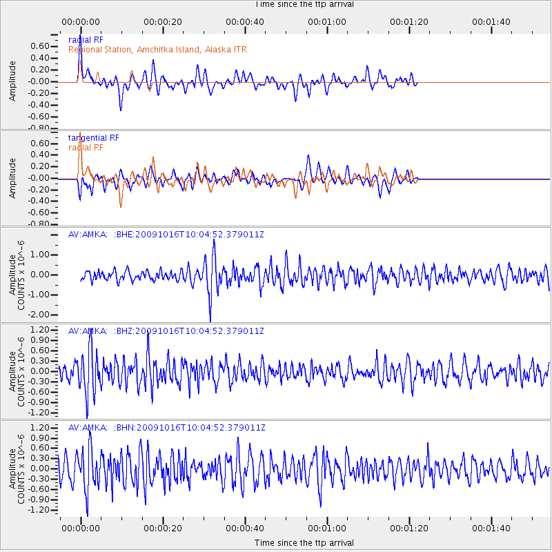
AMKA Regional Station, Amchitka Island, Alaska - Earthquake Result Viewer
*The percent match for this event was below the threshold and hence no stack was calculated.
| Earthquake location: |
Sunda Strait, Indonesia |
| Earthquake latitude/longitude: |
-6.5/105.2 |
| Earthquake time(UTC): |
2009/10/16 (289) 09:52:50 GMT |
| Earthquake Depth: |
38 km |
| Earthquake Magnitude: |
5.9 MB, 5.8 MS, 6.1 MW, 6.1 MW |
| Earthquake Catalog/Contributor: |
WHDF/NEIC |
|
| Network: |
AV Alaska Volcano Observatory |
| Station: |
AMKA Regional Station, Amchitka Island, Alaska |
| Lat/Lon: |
51.38 N/179.30 E |
| Elevation: |
116 m |
|
| Distance: |
85.3 deg |
| Az: |
37.212 deg |
| Baz: |
253.489 deg |
| Ray Param: |
$rayparam |
*The percent match for this event was below the threshold and hence was not used in the summary stack. |
|
| Radial Match: |
54.48828 % |
| Radial Bump: |
400 |
| Transverse Match: |
56.25535 % |
| Transverse Bump: |
384 |
| SOD ConfigId: |
2622 |
| Insert Time: |
2010-03-09 01:20:15.389 +0000 |
| GWidth: |
2.5 |
| Max Bumps: |
400 |
| Tol: |
0.001 |
|
Signal To Noise
| Channel | StoN | STA | LTA |
| AV:AMKA: :BHZ:20091016T10:04:52.379011Z | 2.2338505 | 6.306291E-7 | 2.8230585E-7 |
| AV:AMKA: :BHN:20091016T10:04:52.379011Z | 2.4231782 | 5.949614E-7 | 2.4552938E-7 |
| AV:AMKA: :BHE:20091016T10:04:52.379011Z | 4.227136 | 9.0422066E-7 | 2.1390858E-7 |
| Arrivals |
| Ps | |
| PpPs | |
| PsPs/PpSs | |


