You are here: Home > Network List > AV - Alaska Volcano Observatory Stations List
> Station AMKA Regional Station, Amchitka Island, Alaska > Earthquake Result Viewer
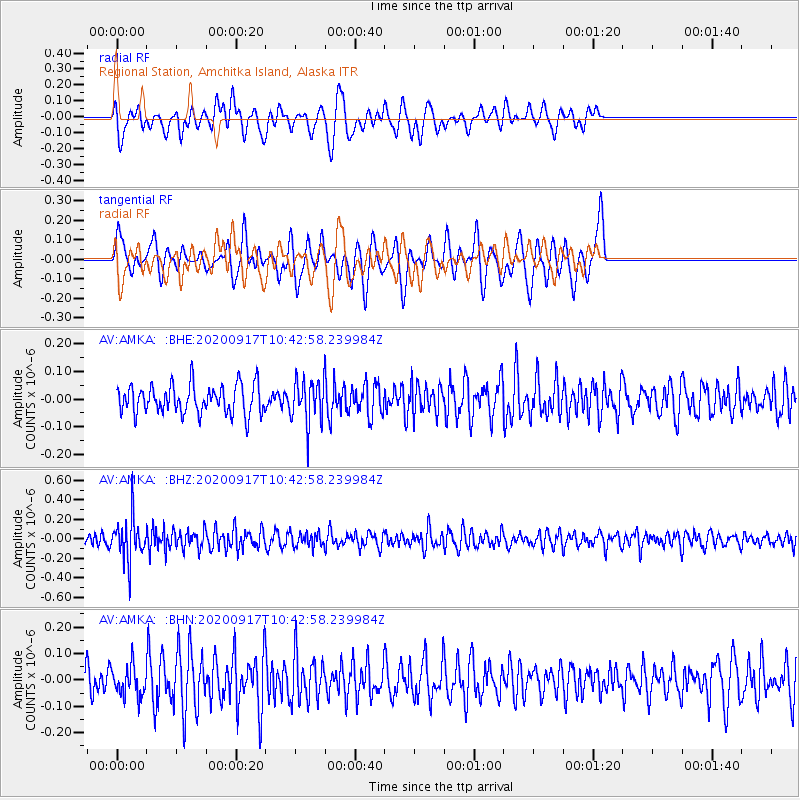
AMKA Regional Station, Amchitka Island, Alaska - Earthquake Result Viewer
*The percent match for this event was below the threshold and hence no stack was calculated.
| Earthquake location: |
Banda Sea |
| Earthquake latitude/longitude: |
-6.8/129.4 |
| Earthquake time(UTC): |
2020/09/17 (261) 10:32:25 GMT |
| Earthquake Depth: |
183 km |
| Earthquake Magnitude: |
5.5 Mww |
| Earthquake Catalog/Contributor: |
NEIC PDE/us |
|
| Network: |
AV Alaska Volcano Observatory |
| Station: |
AMKA Regional Station, Amchitka Island, Alaska |
| Lat/Lon: |
51.38 N/179.30 E |
| Elevation: |
116 m |
|
| Distance: |
72.0 deg |
| Az: |
30.292 deg |
| Baz: |
233.06 deg |
| Ray Param: |
$rayparam |
*The percent match for this event was below the threshold and hence was not used in the summary stack. |
|
| Radial Match: |
38.402973 % |
| Radial Bump: |
350 |
| Transverse Match: |
53.15311 % |
| Transverse Bump: |
317 |
| SOD ConfigId: |
22732711 |
| Insert Time: |
2020-10-01 10:34:46.401 +0000 |
| GWidth: |
2.5 |
| Max Bumps: |
400 |
| Tol: |
0.001 |
|
Signal To Noise
| Channel | StoN | STA | LTA |
| AV:AMKA: :BHZ:20200917T10:42:58.239984Z | 3.2146826 | 2.1394617E-7 | 6.6552815E-8 |
| AV:AMKA: :BHN:20200917T10:42:58.239984Z | 1.1843495 | 5.7566805E-8 | 4.860626E-8 |
| AV:AMKA: :BHE:20200917T10:42:58.239984Z | 1.5036697 | 7.769821E-8 | 5.167239E-8 |
| Arrivals |
| Ps | |
| PpPs | |
| PsPs/PpSs | |


