KABU KABU - Katmai Volcanic Cluster, Alaska - Earthquake Result Viewer
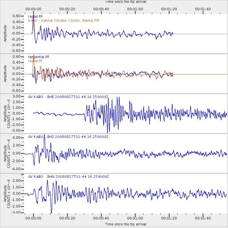
Earthquake location: Lake Baykal Region, Russia
Earthquake latitude/longitude: 51.6/104.2
Earthquake time(UTC): 2008/08/27 (240) 01:35:32 GMT
Earthquake Depth: 16 km
Earthquake Magnitude: 5.8 MB, 6.2 MS, 6.2 MW, 6.2 MW
Earthquake Catalog/Contributor: WHDF/NEIC
Network: AV Alaska Volcano Observatory
Station: KABU KABU - Katmai Volcanic Cluster, Alaska
Lat/Lon: 58.27 N/155.28 W
Elevation: 1065 m
Distance: 52.9 deg
Az: 40.647 deg
Baz: 309.765 deg
Ray Param: 0.06644806
Estimated Moho Depth: 35.0 km
Estimated Crust Vp/Vs: 1.76
Assumed Crust Vp: 6.438 km/s
Estimated Crust Vs: 3.653 km/s
Estimated Crust Poisson's Ratio: 0.26
Radial Match: 81.066605 %
Radial Bump: 400
Transverse Match: 79.97403 %
Transverse Bump: 400
SOD ConfigId: 2504
Insert Time: 2010-03-09 01:20:22.818 +0000
GWidth: 2.5
Max Bumps: 400
Tol: 0.001

Signal To Noise

ChannelStoNSTALTA
AV:KABU: :BHZ:20080827T01:44:16.259009Z6.6804371.3579295E-62.0326955E-7
AV:KABU: :BHN:20080827T01:44:16.259009Z4.7852847.34809E-71.5355599E-7
AV:KABU: :BHE:20080827T01:44:16.259009Z4.90890177.823864E-71.5938114E-7
Arrivals
Ps4.4 SECOND
PpPs14 SECOND
PsPs/PpSs19 SECOND