You are here: Home > Network List > TA - USArray Transportable Network (new EarthScope stations) Stations List
> Station L15K Ungalak Mountain, AK, USA > Earthquake Result Viewer
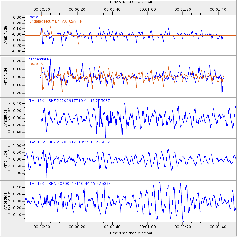
L15K Ungalak Mountain, AK, USA - Earthquake Result Viewer
*The percent match for this event was below the threshold and hence no stack was calculated.
| Earthquake location: |
Banda Sea |
| Earthquake latitude/longitude: |
-6.8/129.4 |
| Earthquake time(UTC): |
2020/09/17 (261) 10:32:25 GMT |
| Earthquake Depth: |
183 km |
| Earthquake Magnitude: |
5.5 Mww |
| Earthquake Catalog/Contributor: |
NEIC PDE/us |
|
| Network: |
TA USArray Transportable Network (new EarthScope stations) |
| Station: |
L15K Ungalak Mountain, AK, USA |
| Lat/Lon: |
61.68 N/161.49 W |
| Elevation: |
219 m |
|
| Distance: |
86.2 deg |
| Az: |
26.528 deg |
| Baz: |
248.447 deg |
| Ray Param: |
$rayparam |
*The percent match for this event was below the threshold and hence was not used in the summary stack. |
|
| Radial Match: |
46.266273 % |
| Radial Bump: |
400 |
| Transverse Match: |
46.74181 % |
| Transverse Bump: |
400 |
| SOD ConfigId: |
22732711 |
| Insert Time: |
2020-10-01 10:39:40.671 +0000 |
| GWidth: |
2.5 |
| Max Bumps: |
400 |
| Tol: |
0.001 |
|
Signal To Noise
| Channel | StoN | STA | LTA |
| TA:L15K: :BHZ:20200917T10:44:15.22503Z | 1.9128848 | 4.8101367E-7 | 2.5145982E-7 |
| TA:L15K: :BHN:20200917T10:44:15.22503Z | 0.55501705 | 1.0177197E-7 | 1.8336728E-7 |
| TA:L15K: :BHE:20200917T10:44:15.22503Z | 1.8390226 | 2.2507545E-7 | 1.2238863E-7 |
| Arrivals |
| Ps | |
| PpPs | |
| PsPs/PpSs | |


