You are here: Home > Network List > UU - University of Utah Regional Network Stations List
> Station CCUT Cedar City, UT, USA > Earthquake Result Viewer
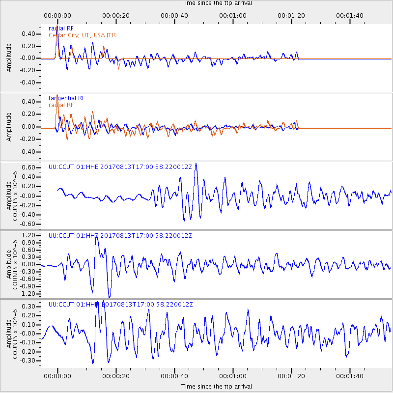
CCUT Cedar City, UT, USA - Earthquake Result Viewer
*The percent match for this event was below the threshold and hence no stack was calculated.
| Earthquake location: |
Central Peru |
| Earthquake latitude/longitude: |
-10.7/-74.6 |
| Earthquake time(UTC): |
2017/08/13 (225) 16:51:22 GMT |
| Earthquake Depth: |
21 km |
| Earthquake Magnitude: |
5.6 mb |
| Earthquake Catalog/Contributor: |
NEIC PDE/us |
|
| Network: |
UU University of Utah Regional Network |
| Station: |
CCUT Cedar City, UT, USA |
| Lat/Lon: |
37.55 N/113.36 W |
| Elevation: |
2127 m |
|
| Distance: |
60.2 deg |
| Az: |
324.985 deg |
| Baz: |
134.804 deg |
| Ray Param: |
$rayparam |
*The percent match for this event was below the threshold and hence was not used in the summary stack. |
|
| Radial Match: |
74.79126 % |
| Radial Bump: |
400 |
| Transverse Match: |
73.275764 % |
| Transverse Bump: |
400 |
| SOD ConfigId: |
2140511 |
| Insert Time: |
2017-08-27 08:53:43.379 +0000 |
| GWidth: |
2.5 |
| Max Bumps: |
400 |
| Tol: |
0.001 |
|
Signal To Noise
| Channel | StoN | STA | LTA |
| UU:CCUT:01:HHZ:20170813T17:00:58.220012Z | 4.1679535 | 2.467824E-7 | 5.920949E-8 |
| UU:CCUT:01:HHN:20170813T17:00:58.220012Z | 1.3521804 | 7.9636905E-8 | 5.8895175E-8 |
| UU:CCUT:01:HHE:20170813T17:00:58.220012Z | 1.5452303 | 1.03054624E-7 | 6.669209E-8 |
| Arrivals |
| Ps | |
| PpPs | |
| PsPs/PpSs | |


