You are here: Home > Network List > TA - USArray Transportable Network (new EarthScope stations) Stations List
> Station R33M Jennings River, BC, CAN > Earthquake Result Viewer
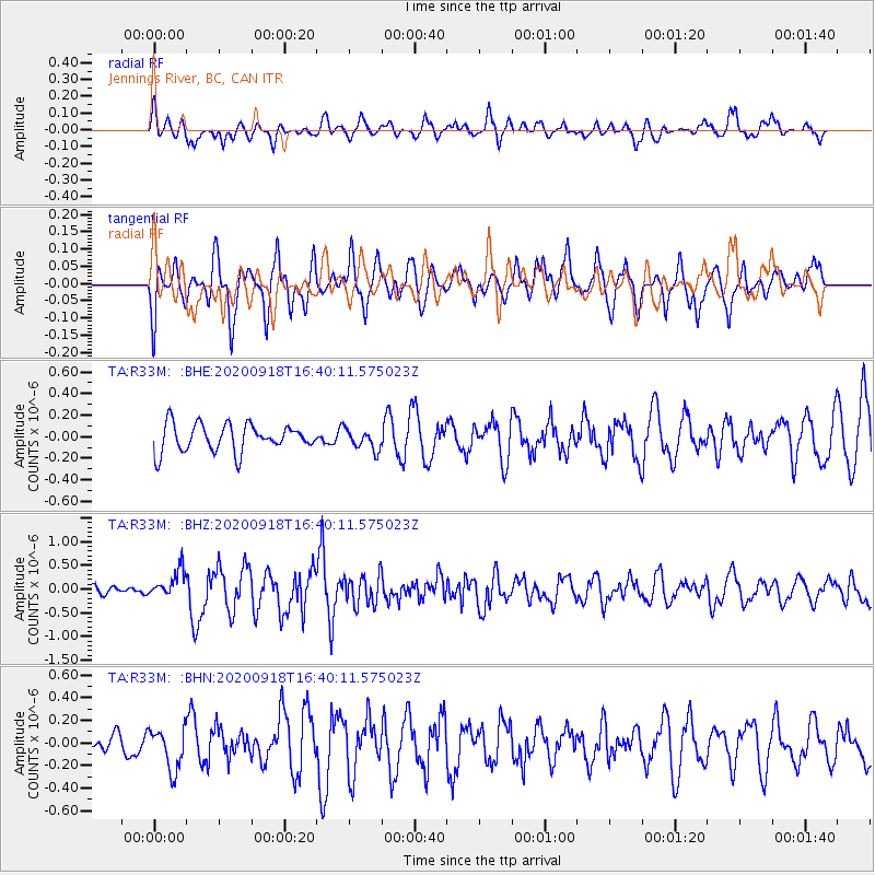
R33M Jennings River, BC, CAN - Earthquake Result Viewer
*The percent match for this event was below the threshold and hence no stack was calculated.
| Earthquake location: |
Crete, Greece |
| Earthquake latitude/longitude: |
35.0/25.3 |
| Earthquake time(UTC): |
2020/09/18 (262) 16:28:17 GMT |
| Earthquake Depth: |
44 km |
| Earthquake Magnitude: |
5.9 Mww |
| Earthquake Catalog/Contributor: |
NEIC PDE/us |
|
| Network: |
TA USArray Transportable Network (new EarthScope stations) |
| Station: |
R33M Jennings River, BC, CAN |
| Lat/Lon: |
59.39 N/130.97 W |
| Elevation: |
1437 m |
|
| Distance: |
83.9 deg |
| Az: |
348.063 deg |
| Baz: |
19.383 deg |
| Ray Param: |
$rayparam |
*The percent match for this event was below the threshold and hence was not used in the summary stack. |
|
| Radial Match: |
62.597084 % |
| Radial Bump: |
400 |
| Transverse Match: |
73.678734 % |
| Transverse Bump: |
400 |
| SOD ConfigId: |
22732711 |
| Insert Time: |
2020-10-02 16:43:23.919 +0000 |
| GWidth: |
2.5 |
| Max Bumps: |
400 |
| Tol: |
0.001 |
|
Signal To Noise
| Channel | StoN | STA | LTA |
| TA:R33M: :BHZ:20200918T16:40:11.575023Z | 3.0676494 | 2.8072716E-7 | 9.151215E-8 |
| TA:R33M: :BHN:20200918T16:40:11.575023Z | 2.0898855 | 1.8250238E-7 | 8.732649E-8 |
| TA:R33M: :BHE:20200918T16:40:11.575023Z | 0.7545389 | 9.515585E-8 | 1.2611126E-7 |
| Arrivals |
| Ps | |
| PpPs | |
| PsPs/PpSs | |


