You are here: Home > Network List > GM - US Geological Survey Networks Stations List
> Station IWM01 Jericho 2M Well Monitoring Station > Earthquake Result Viewer
IWM01 Jericho 2M Well Monitoring Station - Earthquake Result Viewer
*The percent match for this event was below the threshold and hence no stack was calculated.
| Earthquake location: |
Pacific-Antarctic Ridge |
| Earthquake latitude/longitude: |
-55.0/-129.8 |
| Earthquake time(UTC): |
2017/08/14 (226) 05:35:09 GMT |
| Earthquake Depth: |
10 km |
| Earthquake Magnitude: |
5.5 mb |
| Earthquake Catalog/Contributor: |
NEIC PDE/us |
|
| Network: |
GM US Geological Survey Networks |
| Station: |
IWM01 Jericho 2M Well Monitoring Station |
| Lat/Lon: |
36.73 N/96.53 W |
| Elevation: |
328 m |
|
| Distance: |
95.7 deg |
| Az: |
26.301 deg |
| Baz: |
198.513 deg |
| Ray Param: |
$rayparam |
*The percent match for this event was below the threshold and hence was not used in the summary stack. |
|
| Radial Match: |
46.33687 % |
| Radial Bump: |
400 |
| Transverse Match: |
32.30068 % |
| Transverse Bump: |
400 |
| SOD ConfigId: |
2140511 |
| Insert Time: |
2017-08-27 21:35:07.656 +0000 |
| GWidth: |
2.5 |
| Max Bumps: |
400 |
| Tol: |
0.001 |
|
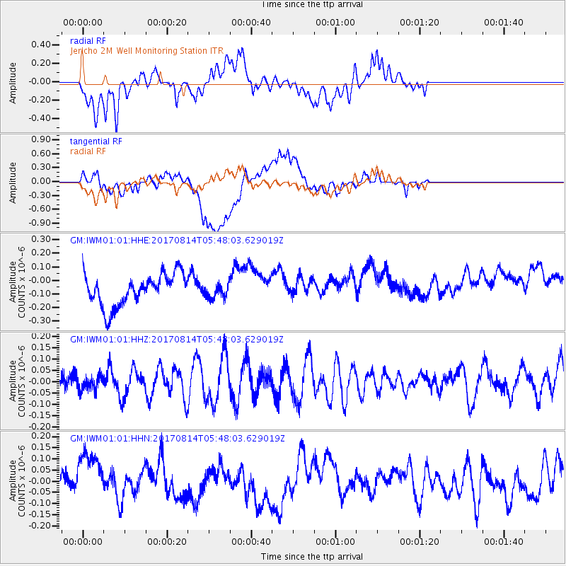
Signal To Noise
| Channel | StoN | STA | LTA |
| GM:IWM01:01:HHZ:20170814T05:48:03.629019Z | 0.6912884 | 3.3548414E-8 | 4.8530275E-8 |
| GM:IWM01:01:HHN:20170814T05:48:03.629019Z | 1.961681 | 1.0991867E-7 | 5.60329E-8 |
| GM:IWM01:01:HHE:20170814T05:48:03.629019Z | 0.46399274 | 5.3774606E-8 | 1.1589536E-7 |
| Arrivals |
| Ps | |
| PpPs | |
| PsPs/PpSs | |


