You are here: Home > Network List > US - United States National Seismic Network Stations List
> Station HAWA Hanford, Washington, USA > Earthquake Result Viewer
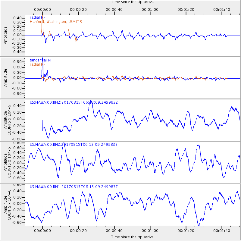
HAWA Hanford, Washington, USA - Earthquake Result Viewer
*The percent match for this event was below the threshold and hence no stack was calculated.
| Earthquake location: |
Samoa Islands Region |
| Earthquake latitude/longitude: |
-14.8/-173.1 |
| Earthquake time(UTC): |
2017/08/15 (227) 06:01:44 GMT |
| Earthquake Depth: |
10 km |
| Earthquake Magnitude: |
5.2 mb |
| Earthquake Catalog/Contributor: |
NEIC PDE/us |
|
| Network: |
US United States National Seismic Network |
| Station: |
HAWA Hanford, Washington, USA |
| Lat/Lon: |
46.39 N/119.53 W |
| Elevation: |
364 m |
|
| Distance: |
77.6 deg |
| Az: |
34.746 deg |
| Baz: |
232.794 deg |
| Ray Param: |
$rayparam |
*The percent match for this event was below the threshold and hence was not used in the summary stack. |
|
| Radial Match: |
54.518513 % |
| Radial Bump: |
358 |
| Transverse Match: |
89.33334 % |
| Transverse Bump: |
280 |
| SOD ConfigId: |
2140511 |
| Insert Time: |
2017-08-28 22:03:31.682 +0000 |
| GWidth: |
2.5 |
| Max Bumps: |
400 |
| Tol: |
0.001 |
|
Signal To Noise
| Channel | StoN | STA | LTA |
| US:HAWA:00:BHZ:20170815T06:13:09.249983Z | 1.8317597 | 5.484342E-7 | 2.994029E-7 |
| US:HAWA:00:BH1:20170815T06:13:09.249983Z | 2.1573217 | 7.14634E-7 | 3.3125983E-7 |
| US:HAWA:00:BH2:20170815T06:13:09.249983Z | 2.0094442 | 3.489095E-7 | 1.7363482E-7 |
| Arrivals |
| Ps | |
| PpPs | |
| PsPs/PpSs | |


