You are here: Home > Network List > US - United States National Seismic Network Stations List
> Station MNTX Cornudas Mountains, Texas, USA > Earthquake Result Viewer
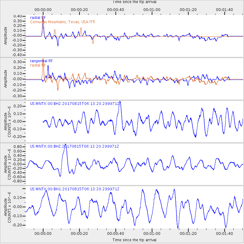
MNTX Cornudas Mountains, Texas, USA - Earthquake Result Viewer
*The percent match for this event was below the threshold and hence no stack was calculated.
| Earthquake location: |
Samoa Islands Region |
| Earthquake latitude/longitude: |
-14.8/-173.1 |
| Earthquake time(UTC): |
2017/08/15 (227) 06:01:44 GMT |
| Earthquake Depth: |
10 km |
| Earthquake Magnitude: |
5.2 mb |
| Earthquake Catalog/Contributor: |
NEIC PDE/us |
|
| Network: |
US United States National Seismic Network |
| Station: |
MNTX Cornudas Mountains, Texas, USA |
| Lat/Lon: |
31.70 N/105.38 W |
| Elevation: |
404 m |
|
| Distance: |
79.6 deg |
| Az: |
53.294 deg |
| Baz: |
245.467 deg |
| Ray Param: |
$rayparam |
*The percent match for this event was below the threshold and hence was not used in the summary stack. |
|
| Radial Match: |
60.776413 % |
| Radial Bump: |
400 |
| Transverse Match: |
57.854492 % |
| Transverse Bump: |
400 |
| SOD ConfigId: |
2140511 |
| Insert Time: |
2017-08-28 22:04:20.819 +0000 |
| GWidth: |
2.5 |
| Max Bumps: |
400 |
| Tol: |
0.001 |
|
Signal To Noise
| Channel | StoN | STA | LTA |
| US:MNTX:00:BHZ:20170815T06:13:20.299971Z | 1.394723 | 1.3557218E-7 | 9.720365E-8 |
| US:MNTX:00:BH1:20170815T06:13:20.299971Z | 2.992689 | 1.3765418E-7 | 4.5996824E-8 |
| US:MNTX:00:BH2:20170815T06:13:20.299971Z | 1.4847051 | 8.2625974E-8 | 5.565144E-8 |
| Arrivals |
| Ps | |
| PpPs | |
| PsPs/PpSs | |


