You are here: Home > Network List > TA - USArray Transportable Network (new EarthScope stations) Stations List
> Station M31M Drury Creek, Yukon, CA > Earthquake Result Viewer
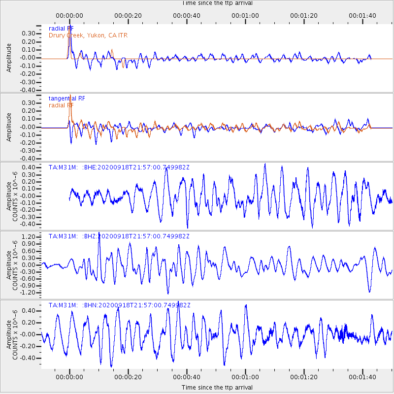
M31M Drury Creek, Yukon, CA - Earthquake Result Viewer
*The percent match for this event was below the threshold and hence no stack was calculated.
| Earthquake location: |
Central Mid-Atlantic Ridge |
| Earthquake latitude/longitude: |
1.0/-26.8 |
| Earthquake time(UTC): |
2020/09/18 (262) 21:43:59 GMT |
| Earthquake Depth: |
10 km |
| Earthquake Magnitude: |
6.9 Mww |
| Earthquake Catalog/Contributor: |
NEIC PDE/us |
|
| Network: |
TA USArray Transportable Network (new EarthScope stations) |
| Station: |
M31M Drury Creek, Yukon, CA |
| Lat/Lon: |
62.20 N/134.39 W |
| Elevation: |
639 m |
|
| Distance: |
97.3 deg |
| Az: |
333.218 deg |
| Baz: |
73.951 deg |
| Ray Param: |
$rayparam |
*The percent match for this event was below the threshold and hence was not used in the summary stack. |
|
| Radial Match: |
78.813614 % |
| Radial Bump: |
400 |
| Transverse Match: |
47.414017 % |
| Transverse Bump: |
369 |
| SOD ConfigId: |
22732711 |
| Insert Time: |
2020-10-02 22:08:31.917 +0000 |
| GWidth: |
2.5 |
| Max Bumps: |
400 |
| Tol: |
0.001 |
|
Signal To Noise
| Channel | StoN | STA | LTA |
| TA:M31M: :BHZ:20200918T21:57:00.749982Z | 2.576987 | 1.892566E-7 | 7.3441036E-8 |
| TA:M31M: :BHN:20200918T21:57:00.749982Z | 1.6950513 | 2.1887145E-7 | 1.2912379E-7 |
| TA:M31M: :BHE:20200918T21:57:00.749982Z | 2.9952912 | 2.3157068E-7 | 7.731157E-8 |
| Arrivals |
| Ps | |
| PpPs | |
| PsPs/PpSs | |


