You are here: Home > Network List > G - GEOSCOPE Stations List
> Station CLF Chambon la Foret observatory, France > Earthquake Result Viewer
CLF Chambon la Foret observatory, France - Earthquake Result Viewer
*The percent match for this event was below the threshold and hence no stack was calculated.
| Earthquake location: |
Northwest Of Ryukyu Islands |
| Earthquake latitude/longitude: |
28.6/127.9 |
| Earthquake time(UTC): |
2017/08/16 (228) 12:51:25 GMT |
| Earthquake Depth: |
197 km |
| Earthquake Magnitude: |
5.7 Mww |
| Earthquake Catalog/Contributor: |
NEIC PDE/us |
|
| Network: |
G GEOSCOPE |
| Station: |
CLF Chambon la Foret observatory, France |
| Lat/Lon: |
48.03 N/2.26 E |
| Elevation: |
145 m |
|
| Distance: |
89.5 deg |
| Az: |
326.948 deg |
| Baz: |
45.571 deg |
| Ray Param: |
$rayparam |
*The percent match for this event was below the threshold and hence was not used in the summary stack. |
|
| Radial Match: |
71.99064 % |
| Radial Bump: |
355 |
| Transverse Match: |
66.69154 % |
| Transverse Bump: |
400 |
| SOD ConfigId: |
2140511 |
| Insert Time: |
2017-08-30 04:48:42.217 +0000 |
| GWidth: |
2.5 |
| Max Bumps: |
400 |
| Tol: |
0.001 |
|
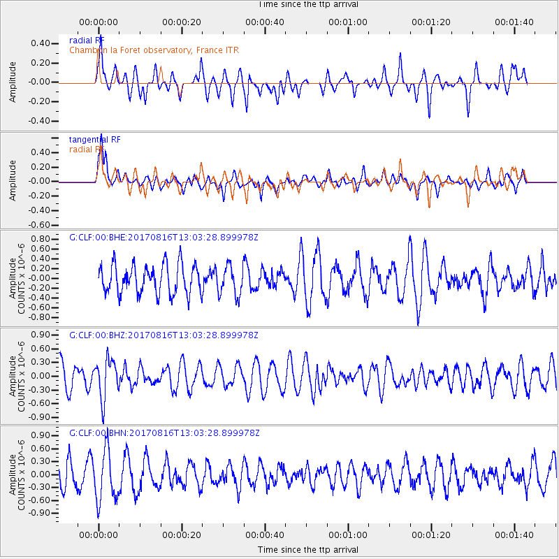
Signal To Noise
| Channel | StoN | STA | LTA |
| G:CLF:00:BHZ:20170816T13:03:28.899978Z | 1.5621536 | 4.3383045E-7 | 2.7771307E-7 |
| G:CLF:00:BHN:20170816T13:03:28.899978Z | 2.044018 | 6.0649467E-7 | 2.9671688E-7 |
| G:CLF:00:BHE:20170816T13:03:28.899978Z | 1.0529355 | 3.0916513E-7 | 2.9362212E-7 |
| Arrivals |
| Ps | |
| PpPs | |
| PsPs/PpSs | |


