You are here: Home > Network List > US - United States National Seismic Network Stations List
> Station CBKS Cedar Bluff, Kansas, USA > Earthquake Result Viewer
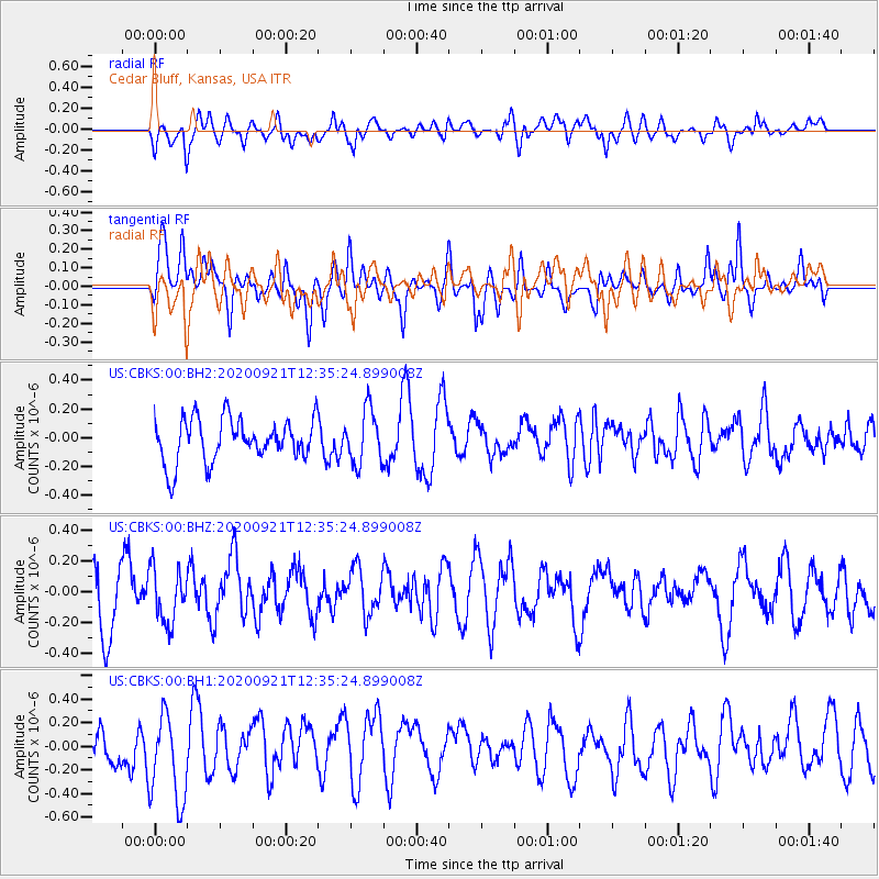
CBKS Cedar Bluff, Kansas, USA - Earthquake Result Viewer
*The percent match for this event was below the threshold and hence no stack was calculated.
| Earthquake location: |
Central East Pacific Rise |
| Earthquake latitude/longitude: |
-4.1/-104.2 |
| Earthquake time(UTC): |
2020/09/21 (265) 12:27:57 GMT |
| Earthquake Depth: |
10 km |
| Earthquake Magnitude: |
5.5 Mww |
| Earthquake Catalog/Contributor: |
NEIC PDE/us |
|
| Network: |
US United States National Seismic Network |
| Station: |
CBKS Cedar Bluff, Kansas, USA |
| Lat/Lon: |
38.81 N/99.74 W |
| Elevation: |
677 m |
|
| Distance: |
42.9 deg |
| Az: |
5.143 deg |
| Baz: |
186.573 deg |
| Ray Param: |
$rayparam |
*The percent match for this event was below the threshold and hence was not used in the summary stack. |
|
| Radial Match: |
51.27641 % |
| Radial Bump: |
400 |
| Transverse Match: |
56.8542 % |
| Transverse Bump: |
400 |
| SOD ConfigId: |
22732711 |
| Insert Time: |
2020-10-05 12:44:10.890 +0000 |
| GWidth: |
2.5 |
| Max Bumps: |
400 |
| Tol: |
0.001 |
|
Signal To Noise
| Channel | StoN | STA | LTA |
| US:CBKS:00:BHZ:20200921T12:35:24.899008Z | 0.7472639 | 1.772786E-7 | 2.3723693E-7 |
| US:CBKS:00:BH1:20200921T12:35:24.899008Z | 1.956886 | 3.8900015E-7 | 1.9878527E-7 |
| US:CBKS:00:BH2:20200921T12:35:24.899008Z | 1.2673728 | 1.880475E-7 | 1.4837583E-7 |
| Arrivals |
| Ps | |
| PpPs | |
| PsPs/PpSs | |


