You are here: Home > Network List > US - United States National Seismic Network Stations List
> Station BOZ Bozeman, Montana, USA > Earthquake Result Viewer
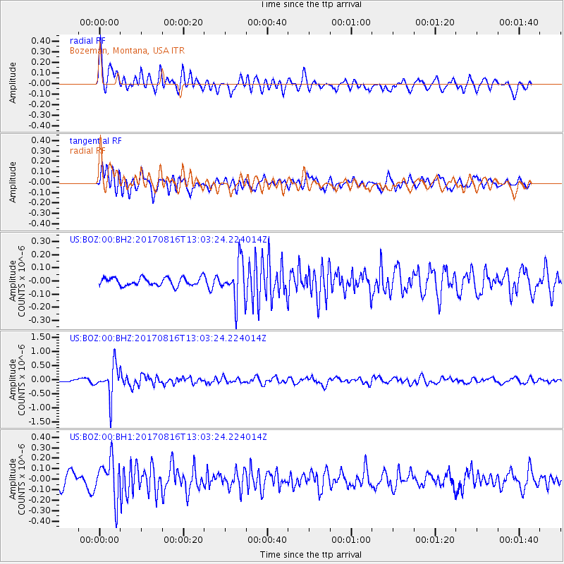
BOZ Bozeman, Montana, USA - Earthquake Result Viewer
*The percent match for this event was below the threshold and hence no stack was calculated.
| Earthquake location: |
Northwest Of Ryukyu Islands |
| Earthquake latitude/longitude: |
28.6/127.9 |
| Earthquake time(UTC): |
2017/08/16 (228) 12:51:25 GMT |
| Earthquake Depth: |
197 km |
| Earthquake Magnitude: |
5.7 Mww |
| Earthquake Catalog/Contributor: |
NEIC PDE/us |
|
| Network: |
US United States National Seismic Network |
| Station: |
BOZ Bozeman, Montana, USA |
| Lat/Lon: |
45.65 N/111.63 W |
| Elevation: |
1589 m |
|
| Distance: |
88.4 deg |
| Az: |
37.227 deg |
| Baz: |
310.71 deg |
| Ray Param: |
$rayparam |
*The percent match for this event was below the threshold and hence was not used in the summary stack. |
|
| Radial Match: |
75.780655 % |
| Radial Bump: |
400 |
| Transverse Match: |
75.097084 % |
| Transverse Bump: |
400 |
| SOD ConfigId: |
2140511 |
| Insert Time: |
2017-08-30 04:51:31.993 +0000 |
| GWidth: |
2.5 |
| Max Bumps: |
400 |
| Tol: |
0.001 |
|
Signal To Noise
| Channel | StoN | STA | LTA |
| US:BOZ:00:BHZ:20170816T13:03:24.224014Z | 14.347426 | 5.695337E-7 | 3.969588E-8 |
| US:BOZ:00:BH1:20170816T13:03:24.224014Z | 2.6419342 | 1.9286117E-7 | 7.299999E-8 |
| US:BOZ:00:BH2:20170816T13:03:24.224014Z | 5.000375 | 1.5008406E-7 | 3.001456E-8 |
| Arrivals |
| Ps | |
| PpPs | |
| PsPs/PpSs | |


