You are here: Home > Network List > US - United States National Seismic Network Stations List
> Station EGMT Eagleton, Montana, USA > Earthquake Result Viewer
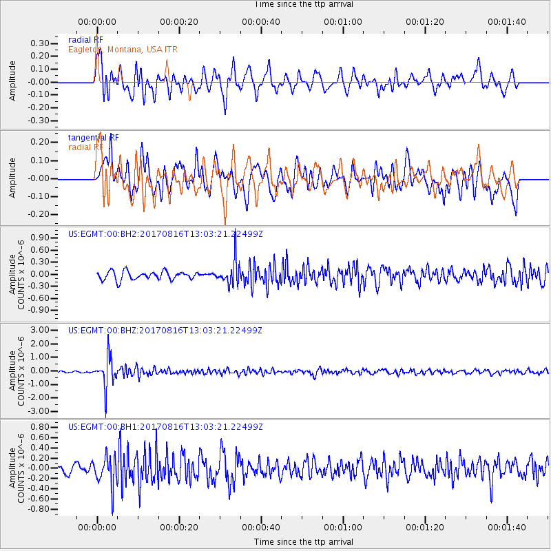
EGMT Eagleton, Montana, USA - Earthquake Result Viewer
*The percent match for this event was below the threshold and hence no stack was calculated.
| Earthquake location: |
Northwest Of Ryukyu Islands |
| Earthquake latitude/longitude: |
28.6/127.9 |
| Earthquake time(UTC): |
2017/08/16 (228) 12:51:25 GMT |
| Earthquake Depth: |
197 km |
| Earthquake Magnitude: |
5.7 Mww |
| Earthquake Catalog/Contributor: |
NEIC PDE/us |
|
| Network: |
US United States National Seismic Network |
| Station: |
EGMT Eagleton, Montana, USA |
| Lat/Lon: |
48.02 N/109.75 W |
| Elevation: |
1055 m |
|
| Distance: |
87.8 deg |
| Az: |
34.59 deg |
| Baz: |
311.988 deg |
| Ray Param: |
$rayparam |
*The percent match for this event was below the threshold and hence was not used in the summary stack. |
|
| Radial Match: |
69.33722 % |
| Radial Bump: |
400 |
| Transverse Match: |
55.459957 % |
| Transverse Bump: |
400 |
| SOD ConfigId: |
2140511 |
| Insert Time: |
2017-08-30 04:51:38.090 +0000 |
| GWidth: |
2.5 |
| Max Bumps: |
400 |
| Tol: |
0.001 |
|
Signal To Noise
| Channel | StoN | STA | LTA |
| US:EGMT:00:BHZ:20170816T13:03:21.22499Z | 14.672254 | 1.0974862E-6 | 7.480011E-8 |
| US:EGMT:00:BH1:20170816T13:03:21.22499Z | 2.5642703 | 2.848724E-7 | 1.1109298E-7 |
| US:EGMT:00:BH2:20170816T13:03:21.22499Z | 2.8779545 | 3.0441416E-7 | 1.0577448E-7 |
| Arrivals |
| Ps | |
| PpPs | |
| PsPs/PpSs | |


