You are here: Home > Network List > CI - Caltech Regional Seismic Network Stations List
> Station TIN Tinemaha, Big Pine, CA, USA > Earthquake Result Viewer
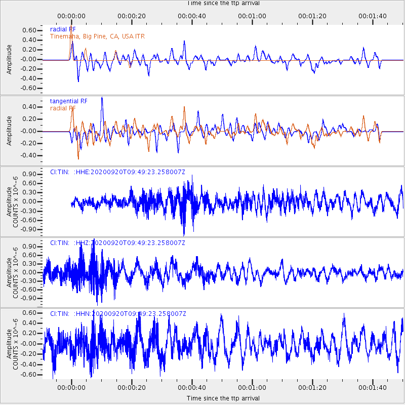
TIN Tinemaha, Big Pine, CA, USA - Earthquake Result Viewer
*The percent match for this event was below the threshold and hence no stack was calculated.
| Earthquake location: |
Galapagos Islands Region |
| Earthquake latitude/longitude: |
2.6/-95.2 |
| Earthquake time(UTC): |
2020/09/20 (264) 09:42:16 GMT |
| Earthquake Depth: |
10 km |
| Earthquake Magnitude: |
5.5 Mww |
| Earthquake Catalog/Contributor: |
NEIC PDE/us |
|
| Network: |
CI Caltech Regional Seismic Network |
| Station: |
TIN Tinemaha, Big Pine, CA, USA |
| Lat/Lon: |
37.05 N/118.23 W |
| Elevation: |
1197 m |
|
| Distance: |
40.3 deg |
| Az: |
331.111 deg |
| Baz: |
142.894 deg |
| Ray Param: |
$rayparam |
*The percent match for this event was below the threshold and hence was not used in the summary stack. |
|
| Radial Match: |
63.301838 % |
| Radial Bump: |
400 |
| Transverse Match: |
67.30175 % |
| Transverse Bump: |
400 |
| SOD ConfigId: |
22732711 |
| Insert Time: |
2020-10-07 05:47:49.374 +0000 |
| GWidth: |
2.5 |
| Max Bumps: |
400 |
| Tol: |
0.001 |
|
Signal To Noise
| Channel | StoN | STA | LTA |
| CI:TIN: :HHZ:20200920T09:49:23.258007Z | 2.7960417 | 3.9296265E-7 | 1.4054248E-7 |
| CI:TIN: :HHN:20200920T09:49:23.258007Z | 1.1642249 | 1.8245824E-7 | 1.5672077E-7 |
| CI:TIN: :HHE:20200920T09:49:23.258007Z | 1.7272766 | 2.544364E-7 | 1.4730496E-7 |
| Arrivals |
| Ps | |
| PpPs | |
| PsPs/PpSs | |


