You are here: Home > Network List > US - United States National Seismic Network Stations List
> Station HLID Hailey, Idaho, USA > Earthquake Result Viewer
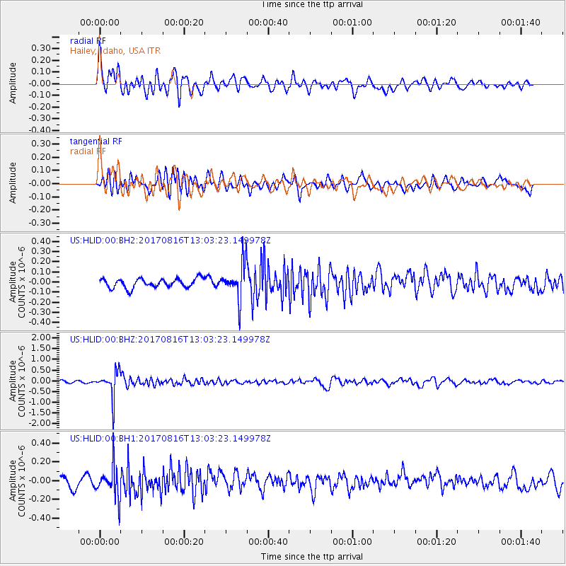
HLID Hailey, Idaho, USA - Earthquake Result Viewer
*The percent match for this event was below the threshold and hence no stack was calculated.
| Earthquake location: |
Northwest Of Ryukyu Islands |
| Earthquake latitude/longitude: |
28.6/127.9 |
| Earthquake time(UTC): |
2017/08/16 (228) 12:51:25 GMT |
| Earthquake Depth: |
197 km |
| Earthquake Magnitude: |
5.7 Mww |
| Earthquake Catalog/Contributor: |
NEIC PDE/us |
|
| Network: |
US United States National Seismic Network |
| Station: |
HLID Hailey, Idaho, USA |
| Lat/Lon: |
43.56 N/114.41 W |
| Elevation: |
1772 m |
|
| Distance: |
88.2 deg |
| Az: |
40.102 deg |
| Baz: |
308.845 deg |
| Ray Param: |
$rayparam |
*The percent match for this event was below the threshold and hence was not used in the summary stack. |
|
| Radial Match: |
69.10802 % |
| Radial Bump: |
400 |
| Transverse Match: |
62.88304 % |
| Transverse Bump: |
400 |
| SOD ConfigId: |
2140511 |
| Insert Time: |
2017-08-30 04:51:49.402 +0000 |
| GWidth: |
2.5 |
| Max Bumps: |
400 |
| Tol: |
0.001 |
|
Signal To Noise
| Channel | StoN | STA | LTA |
| US:HLID:00:BHZ:20170816T13:03:23.149978Z | 10.179051 | 6.126459E-7 | 6.018694E-8 |
| US:HLID:00:BH1:20170816T13:03:23.149978Z | 3.1174643 | 1.6437788E-7 | 5.272807E-8 |
| US:HLID:00:BH2:20170816T13:03:23.149978Z | 4.0471883 | 1.8371858E-7 | 4.5394124E-8 |
| Arrivals |
| Ps | |
| PpPs | |
| PsPs/PpSs | |


