You are here: Home > Network List > UU - University of Utah Regional Network Stations List
> Station FORU South Mineral Mountains, UT, USA > Earthquake Result Viewer
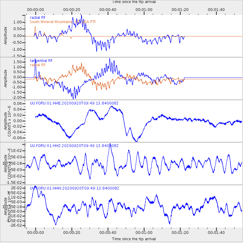
FORU South Mineral Mountains, UT, USA - Earthquake Result Viewer
*The percent match for this event was below the threshold and hence no stack was calculated.
| Earthquake location: |
Galapagos Islands Region |
| Earthquake latitude/longitude: |
2.6/-95.2 |
| Earthquake time(UTC): |
2020/09/20 (264) 09:42:16 GMT |
| Earthquake Depth: |
10 km |
| Earthquake Magnitude: |
5.5 Mww |
| Earthquake Catalog/Contributor: |
NEIC PDE/us |
|
| Network: |
UU University of Utah Regional Network |
| Station: |
FORU South Mineral Mountains, UT, USA |
| Lat/Lon: |
38.46 N/112.86 W |
| Elevation: |
1840 m |
|
| Distance: |
39.2 deg |
| Az: |
337.892 deg |
| Baz: |
151.387 deg |
| Ray Param: |
$rayparam |
*The percent match for this event was below the threshold and hence was not used in the summary stack. |
|
| Radial Match: |
69.4743 % |
| Radial Bump: |
400 |
| Transverse Match: |
53.6471 % |
| Transverse Bump: |
400 |
| SOD ConfigId: |
22732711 |
| Insert Time: |
2020-10-07 05:58:16.708 +0000 |
| GWidth: |
2.5 |
| Max Bumps: |
400 |
| Tol: |
0.001 |
|
Signal To Noise
| Channel | StoN | STA | LTA |
| UU:FORU:01:HHZ:20200920T09:49:13.840008Z | 1.9632121 | 4.7396713E-9 | 2.4142432E-9 |
| UU:FORU:01:HHN:20200920T09:49:13.840008Z | 1.0013138 | 1.8139524E-8 | 1.8115722E-8 |
| UU:FORU:01:HHE:20200920T09:49:13.840008Z | 1.732265 | 4.4766942E-8 | 2.5843011E-8 |
| Arrivals |
| Ps | |
| PpPs | |
| PsPs/PpSs | |


