You are here: Home > Network List > UU - University of Utah Regional Network Stations List
> Station KNB Kanab, UT, USA > Earthquake Result Viewer
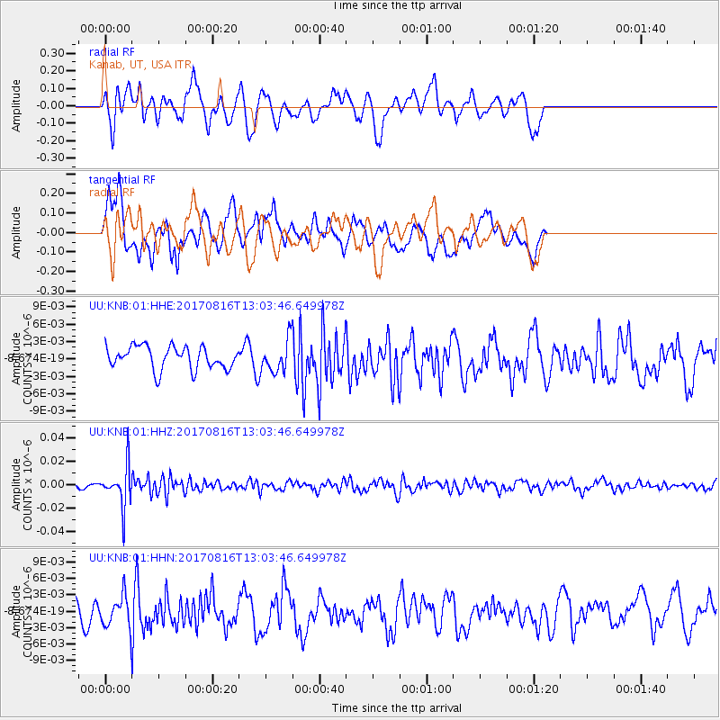
KNB Kanab, UT, USA - Earthquake Result Viewer
*The percent match for this event was below the threshold and hence no stack was calculated.
| Earthquake location: |
Northwest Of Ryukyu Islands |
| Earthquake latitude/longitude: |
28.6/127.9 |
| Earthquake time(UTC): |
2017/08/16 (228) 12:51:25 GMT |
| Earthquake Depth: |
197 km |
| Earthquake Magnitude: |
5.7 Mww |
| Earthquake Catalog/Contributor: |
NEIC PDE/us |
|
| Network: |
UU University of Utah Regional Network |
| Station: |
KNB Kanab, UT, USA |
| Lat/Lon: |
37.02 N/112.82 W |
| Elevation: |
1715 m |
|
| Distance: |
93.3 deg |
| Az: |
44.386 deg |
| Baz: |
309.815 deg |
| Ray Param: |
$rayparam |
*The percent match for this event was below the threshold and hence was not used in the summary stack. |
|
| Radial Match: |
65.46945 % |
| Radial Bump: |
400 |
| Transverse Match: |
69.31206 % |
| Transverse Bump: |
400 |
| SOD ConfigId: |
2140511 |
| Insert Time: |
2017-08-30 04:52:37.017 +0000 |
| GWidth: |
2.5 |
| Max Bumps: |
400 |
| Tol: |
0.001 |
|
Signal To Noise
| Channel | StoN | STA | LTA |
| UU:KNB:01:HHZ:20170816T13:03:46.649978Z | 10.060838 | 1.745384E-8 | 1.7348295E-9 |
| UU:KNB:01:HHN:20170816T13:03:46.649978Z | 1.996995 | 2.7635136E-9 | 1.383836E-9 |
| UU:KNB:01:HHE:20170816T13:03:46.649978Z | 1.4053843 | 2.7511353E-9 | 1.957568E-9 |
| Arrivals |
| Ps | |
| PpPs | |
| PsPs/PpSs | |


