You are here: Home > Network List > GS - US Geological Survey Networks Stations List
> Station KAN13 Rinehart Farm > Earthquake Result Viewer
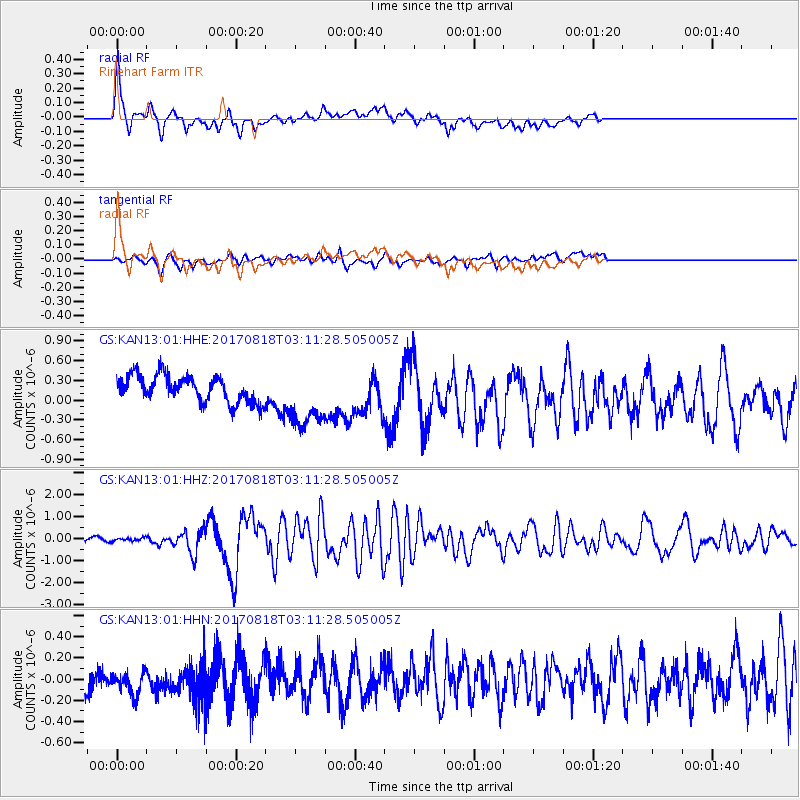
KAN13 Rinehart Farm - Earthquake Result Viewer
*The percent match for this event was below the threshold and hence no stack was calculated.
| Earthquake location: |
North Of Ascension Island |
| Earthquake latitude/longitude: |
-0.9/-13.9 |
| Earthquake time(UTC): |
2017/08/18 (230) 02:59:24 GMT |
| Earthquake Depth: |
19 km |
| Earthquake Magnitude: |
6.7 Mi |
| Earthquake Catalog/Contributor: |
NEIC PDE/pt |
|
| Network: |
GS US Geological Survey Networks |
| Station: |
KAN13 Rinehart Farm |
| Lat/Lon: |
37.01 N/97.48 W |
| Elevation: |
340 m |
|
| Distance: |
85.4 deg |
| Az: |
307.06 deg |
| Baz: |
94.547 deg |
| Ray Param: |
$rayparam |
*The percent match for this event was below the threshold and hence was not used in the summary stack. |
|
| Radial Match: |
71.50805 % |
| Radial Bump: |
400 |
| Transverse Match: |
65.01119 % |
| Transverse Bump: |
400 |
| SOD ConfigId: |
2140511 |
| Insert Time: |
2017-08-31 19:00:01.600 +0000 |
| GWidth: |
2.5 |
| Max Bumps: |
400 |
| Tol: |
0.001 |
|
Signal To Noise
| Channel | StoN | STA | LTA |
| GS:KAN13:01:HHZ:20170818T03:11:28.505005Z | 0.7161467 | 7.642236E-8 | 1.0671327E-7 |
| GS:KAN13:01:HHN:20170818T03:11:28.505005Z | 0.6397702 | 1.02140085E-7 | 1.5965121E-7 |
| GS:KAN13:01:HHE:20170818T03:11:28.505005Z | 2.3036036 | 4.6737233E-7 | 2.0288748E-7 |
| Arrivals |
| Ps | |
| PpPs | |
| PsPs/PpSs | |


