You are here: Home > Network List > TX - Texas Seismological Network Stations List
> Station WTFS Witchita Falls > Earthquake Result Viewer
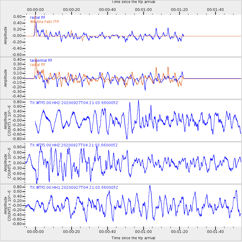
WTFS Witchita Falls - Earthquake Result Viewer
*The percent match for this event was below the threshold and hence no stack was calculated.
| Earthquake location: |
Fox Islands, Aleutian Islands |
| Earthquake latitude/longitude: |
51.9/-169.8 |
| Earthquake time(UTC): |
2020/09/27 (271) 04:12:17 GMT |
| Earthquake Depth: |
14 km |
| Earthquake Magnitude: |
5.6 mww |
| Earthquake Catalog/Contributor: |
NEIC PDE/us |
|
| Network: |
TX Texas Seismological Network |
| Station: |
WTFS Witchita Falls |
| Lat/Lon: |
33.77 N/98.46 W |
| Elevation: |
277 m |
|
| Distance: |
53.1 deg |
| Az: |
80.446 deg |
| Baz: |
312.868 deg |
| Ray Param: |
$rayparam |
*The percent match for this event was below the threshold and hence was not used in the summary stack. |
|
| Radial Match: |
57.974808 % |
| Radial Bump: |
400 |
| Transverse Match: |
72.067276 % |
| Transverse Bump: |
337 |
| SOD ConfigId: |
22732711 |
| Insert Time: |
2020-10-11 04:33:18.687 +0000 |
| GWidth: |
2.5 |
| Max Bumps: |
400 |
| Tol: |
0.001 |
|
Signal To Noise
| Channel | StoN | STA | LTA |
| TX:WTFS:00:HHZ:20200927T04:21:03.660005Z | 2.3093085 | 6.2645853E-7 | 2.7127538E-7 |
| TX:WTFS:00:HH1:20200927T04:21:03.660005Z | 0.586705 | 1.3037271E-7 | 2.2221168E-7 |
| TX:WTFS:00:HH2:20200927T04:21:03.660005Z | 1.1084187 | 2.9952855E-7 | 2.7023052E-7 |
| Arrivals |
| Ps | |
| PpPs | |
| PsPs/PpSs | |


