You are here: Home > Network List > UW - Pacific Northwest Regional Seismic Network Stations List
> Station IRON Crane, OR, USA > Earthquake Result Viewer
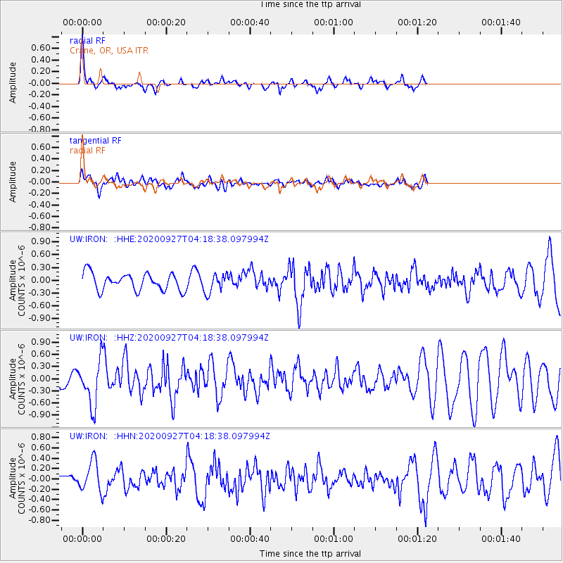
IRON Crane, OR, USA - Earthquake Result Viewer
*The percent match for this event was below the threshold and hence no stack was calculated.
| Earthquake location: |
Fox Islands, Aleutian Islands |
| Earthquake latitude/longitude: |
51.9/-169.8 |
| Earthquake time(UTC): |
2020/09/27 (271) 04:12:17 GMT |
| Earthquake Depth: |
14 km |
| Earthquake Magnitude: |
5.6 mww |
| Earthquake Catalog/Contributor: |
NEIC PDE/us |
|
| Network: |
UW Pacific Northwest Regional Seismic Network |
| Station: |
IRON Crane, OR, USA |
| Lat/Lon: |
43.36 N/118.47 W |
| Elevation: |
1226 m |
|
| Distance: |
35.0 deg |
| Az: |
83.447 deg |
| Baz: |
302.509 deg |
| Ray Param: |
$rayparam |
*The percent match for this event was below the threshold and hence was not used in the summary stack. |
|
| Radial Match: |
71.22191 % |
| Radial Bump: |
271 |
| Transverse Match: |
55.867344 % |
| Transverse Bump: |
400 |
| SOD ConfigId: |
22732711 |
| Insert Time: |
2020-10-11 04:36:10.219 +0000 |
| GWidth: |
2.5 |
| Max Bumps: |
400 |
| Tol: |
0.001 |
|
Signal To Noise
| Channel | StoN | STA | LTA |
| UW:IRON: :HHZ:20200927T04:18:38.097994Z | 3.5786088 | 5.6072565E-7 | 1.5668817E-7 |
| UW:IRON: :HHN:20200927T04:18:38.097994Z | 1.5984699 | 3.000732E-7 | 1.8772526E-7 |
| UW:IRON: :HHE:20200927T04:18:38.097994Z | 1.1131471 | 2.2070357E-7 | 1.982699E-7 |
| Arrivals |
| Ps | |
| PpPs | |
| PsPs/PpSs | |


