You are here: Home > Network List > WY - Yellowstone Wyoming Seismic Network Stations List
> Station YHH Holmes Hill, YNP, WY, USA > Earthquake Result Viewer
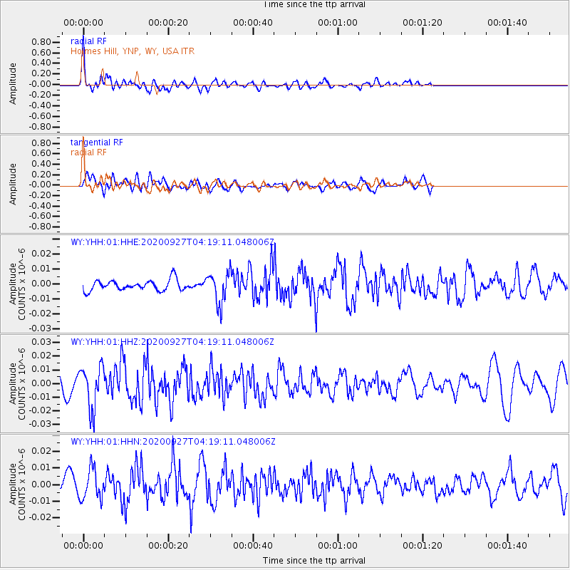
YHH Holmes Hill, YNP, WY, USA - Earthquake Result Viewer
*The percent match for this event was below the threshold and hence no stack was calculated.
| Earthquake location: |
Fox Islands, Aleutian Islands |
| Earthquake latitude/longitude: |
51.9/-169.8 |
| Earthquake time(UTC): |
2020/09/27 (271) 04:12:17 GMT |
| Earthquake Depth: |
14 km |
| Earthquake Magnitude: |
5.6 mww |
| Earthquake Catalog/Contributor: |
NEIC PDE/us |
|
| Network: |
WY Yellowstone Wyoming Seismic Network |
| Station: |
YHH Holmes Hill, YNP, WY, USA |
| Lat/Lon: |
44.79 N/110.85 W |
| Elevation: |
2717 m |
|
| Distance: |
38.8 deg |
| Az: |
76.537 deg |
| Baz: |
302.266 deg |
| Ray Param: |
$rayparam |
*The percent match for this event was below the threshold and hence was not used in the summary stack. |
|
| Radial Match: |
76.191734 % |
| Radial Bump: |
400 |
| Transverse Match: |
71.23489 % |
| Transverse Bump: |
400 |
| SOD ConfigId: |
22732711 |
| Insert Time: |
2020-10-11 04:37:31.506 +0000 |
| GWidth: |
2.5 |
| Max Bumps: |
400 |
| Tol: |
0.001 |
|
Signal To Noise
| Channel | StoN | STA | LTA |
| WY:YHH:01:HHZ:20200927T04:19:11.048006Z | 4.033646 | 1.5635125E-8 | 3.8761767E-9 |
| WY:YHH:01:HHN:20200927T04:19:11.048006Z | 2.1320095 | 9.324862E-9 | 4.373743E-9 |
| WY:YHH:01:HHE:20200927T04:19:11.048006Z | 3.0199764 | 1.0561526E-8 | 3.4972214E-9 |
| Arrivals |
| Ps | |
| PpPs | |
| PsPs/PpSs | |


