You are here: Home > Network List > AV - Alaska Volcano Observatory Stations List
> Station PLBL Mt. Peulik Volcano, Alaska > Earthquake Result Viewer
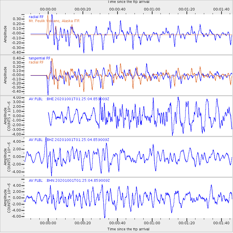
PLBL Mt. Peulik Volcano, Alaska - Earthquake Result Viewer
*The percent match for this event was below the threshold and hence no stack was calculated.
| Earthquake location: |
Tonga Islands |
| Earthquake latitude/longitude: |
-19.1/-173.6 |
| Earthquake time(UTC): |
2020/10/01 (275) 01:13:39 GMT |
| Earthquake Depth: |
10 km |
| Earthquake Magnitude: |
6.7 Mi |
| Earthquake Catalog/Contributor: |
NEIC PDE/at |
|
| Network: |
AV Alaska Volcano Observatory |
| Station: |
PLBL Mt. Peulik Volcano, Alaska |
| Lat/Lon: |
57.70 N/156.82 W |
| Elevation: |
461 m |
|
| Distance: |
77.8 deg |
| Az: |
9.125 deg |
| Baz: |
196.219 deg |
| Ray Param: |
$rayparam |
*The percent match for this event was below the threshold and hence was not used in the summary stack. |
|
| Radial Match: |
72.60234 % |
| Radial Bump: |
400 |
| Transverse Match: |
68.55715 % |
| Transverse Bump: |
400 |
| SOD ConfigId: |
22732711 |
| Insert Time: |
2020-10-15 01:21:27.020 +0000 |
| GWidth: |
2.5 |
| Max Bumps: |
400 |
| Tol: |
0.001 |
|
Signal To Noise
| Channel | StoN | STA | LTA |
| AV:PLBL: :BHZ:20201001T01:25:04.859009Z | 2.1525204 | 1.9642791E-6 | 9.125484E-7 |
| AV:PLBL: :BHN:20201001T01:25:04.859009Z | 2.0768235 | 1.8621868E-6 | 8.9665144E-7 |
| AV:PLBL: :BHE:20201001T01:25:04.859009Z | 1.8222651 | 1.6346017E-6 | 8.970164E-7 |
| Arrivals |
| Ps | |
| PpPs | |
| PsPs/PpSs | |


