You are here: Home > Network List > GS - US Geological Survey Networks Stations List
> Station OK031 S. Brethren Rd., Cushing, OK, USA > Earthquake Result Viewer
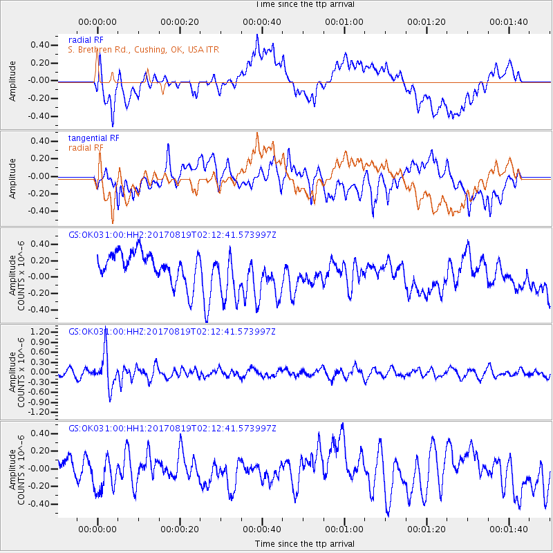
OK031 S. Brethren Rd., Cushing, OK, USA - Earthquake Result Viewer
*The percent match for this event was below the threshold and hence no stack was calculated.
| Earthquake location: |
Fiji Islands Region |
| Earthquake latitude/longitude: |
-18.0/-178.9 |
| Earthquake time(UTC): |
2017/08/19 (231) 02:00:52 GMT |
| Earthquake Depth: |
539 km |
| Earthquake Magnitude: |
6.4 Mww |
| Earthquake Catalog/Contributor: |
NEIC PDE/us |
|
| Network: |
GS US Geological Survey Networks |
| Station: |
OK031 S. Brethren Rd., Cushing, OK, USA |
| Lat/Lon: |
35.95 N/96.84 W |
| Elevation: |
290 m |
|
| Distance: |
94.1 deg |
| Az: |
53.666 deg |
| Baz: |
250.918 deg |
| Ray Param: |
$rayparam |
*The percent match for this event was below the threshold and hence was not used in the summary stack. |
|
| Radial Match: |
65.18551 % |
| Radial Bump: |
400 |
| Transverse Match: |
57.99629 % |
| Transverse Bump: |
400 |
| SOD ConfigId: |
2140511 |
| Insert Time: |
2017-09-01 17:58:32.804 +0000 |
| GWidth: |
2.5 |
| Max Bumps: |
400 |
| Tol: |
0.001 |
|
Signal To Noise
| Channel | StoN | STA | LTA |
| GS:OK031:00:HHZ:20170819T02:12:41.573997Z | 5.46922 | 5.149537E-7 | 9.4154856E-8 |
| GS:OK031:00:HH1:20170819T02:12:41.573997Z | 1.4402072 | 2.221147E-7 | 1.5422413E-7 |
| GS:OK031:00:HH2:20170819T02:12:41.573997Z | 1.7350678 | 3.1226358E-7 | 1.7997198E-7 |
| Arrivals |
| Ps | |
| PpPs | |
| PsPs/PpSs | |


