You are here: Home > Network List > GS - US Geological Survey Networks Stations List
> Station MT01 Lincoln Ranger Stn, Helena Natl Forest, Montana, USA > Earthquake Result Viewer
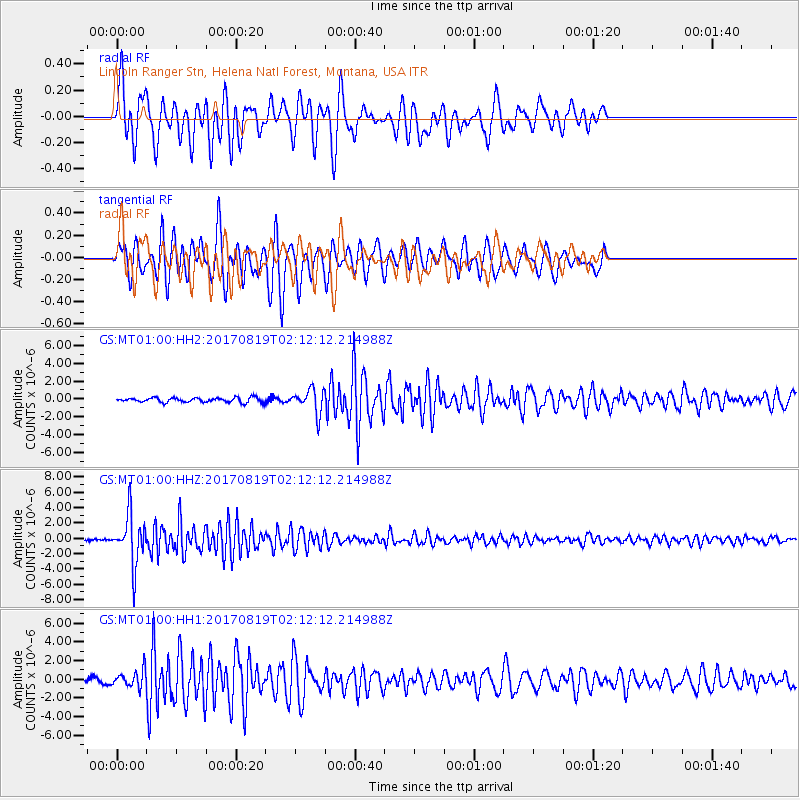
MT01 Lincoln Ranger Stn, Helena Natl Forest, Montana, USA - Earthquake Result Viewer
*The percent match for this event was below the threshold and hence no stack was calculated.
| Earthquake location: |
Fiji Islands Region |
| Earthquake latitude/longitude: |
-18.0/-178.9 |
| Earthquake time(UTC): |
2017/08/19 (231) 02:00:52 GMT |
| Earthquake Depth: |
539 km |
| Earthquake Magnitude: |
6.4 Mww |
| Earthquake Catalog/Contributor: |
NEIC PDE/us |
|
| Network: |
GS US Geological Survey Networks |
| Station: |
MT01 Lincoln Ranger Stn, Helena Natl Forest, Montana, USA |
| Lat/Lon: |
46.95 N/112.66 W |
| Elevation: |
1318 m |
|
| Distance: |
87.7 deg |
| Az: |
38.848 deg |
| Baz: |
240.64 deg |
| Ray Param: |
$rayparam |
*The percent match for this event was below the threshold and hence was not used in the summary stack. |
|
| Radial Match: |
72.57525 % |
| Radial Bump: |
366 |
| Transverse Match: |
64.40267 % |
| Transverse Bump: |
400 |
| SOD ConfigId: |
2140511 |
| Insert Time: |
2017-09-01 17:58:34.114 +0000 |
| GWidth: |
2.5 |
| Max Bumps: |
400 |
| Tol: |
0.001 |
|
Signal To Noise
| Channel | StoN | STA | LTA |
| GS:MT01:00:HHZ:20170819T02:12:12.214988Z | 34.52472 | 3.2188643E-6 | 9.323361E-8 |
| GS:MT01:00:HH1:20170819T02:12:12.214988Z | 3.220745 | 9.113746E-7 | 2.8297012E-7 |
| GS:MT01:00:HH2:20170819T02:12:12.214988Z | 5.296509 | 1.3546855E-6 | 2.5576952E-7 |
| Arrivals |
| Ps | |
| PpPs | |
| PsPs/PpSs | |


