You are here: Home > Network List > CI - Caltech Regional Seismic Network Stations List
> Station MPP McPhearson Peak > Earthquake Result Viewer
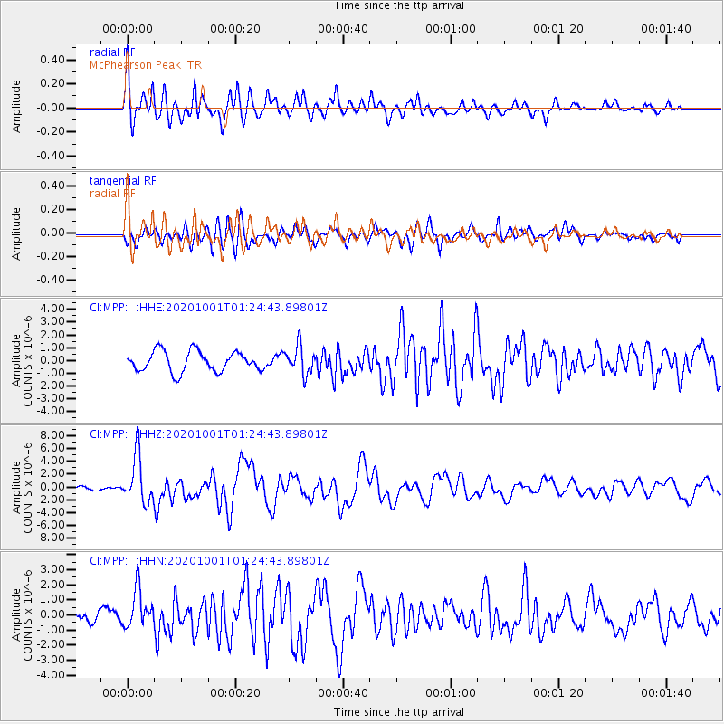
MPP McPhearson Peak - Earthquake Result Viewer
*The percent match for this event was below the threshold and hence no stack was calculated.
| Earthquake location: |
Tonga Islands |
| Earthquake latitude/longitude: |
-19.1/-173.6 |
| Earthquake time(UTC): |
2020/10/01 (275) 01:13:39 GMT |
| Earthquake Depth: |
10 km |
| Earthquake Magnitude: |
6.7 Mi |
| Earthquake Catalog/Contributor: |
NEIC PDE/at |
|
| Network: |
CI Caltech Regional Seismic Network |
| Station: |
MPP McPhearson Peak |
| Lat/Lon: |
34.89 N/119.81 W |
| Elevation: |
1739 m |
|
| Distance: |
74.1 deg |
| Az: |
43.603 deg |
| Baz: |
232.497 deg |
| Ray Param: |
$rayparam |
*The percent match for this event was below the threshold and hence was not used in the summary stack. |
|
| Radial Match: |
79.415695 % |
| Radial Bump: |
400 |
| Transverse Match: |
74.75724 % |
| Transverse Bump: |
400 |
| SOD ConfigId: |
22732711 |
| Insert Time: |
2020-10-15 01:26:34.365 +0000 |
| GWidth: |
2.5 |
| Max Bumps: |
400 |
| Tol: |
0.001 |
|
Signal To Noise
| Channel | StoN | STA | LTA |
| CI:MPP: :HHZ:20201001T01:24:43.89801Z | 14.501784 | 3.7439943E-6 | 2.5817474E-7 |
| CI:MPP: :HHN:20201001T01:24:43.89801Z | 2.9228184 | 1.2693115E-6 | 4.342766E-7 |
| CI:MPP: :HHE:20201001T01:24:43.89801Z | 1.3817362 | 1.0882165E-6 | 7.875719E-7 |
| Arrivals |
| Ps | |
| PpPs | |
| PsPs/PpSs | |


