You are here: Home > Network List > CI - Caltech Regional Seismic Network Stations List
> Station SMM Simmler, CA, USA > Earthquake Result Viewer
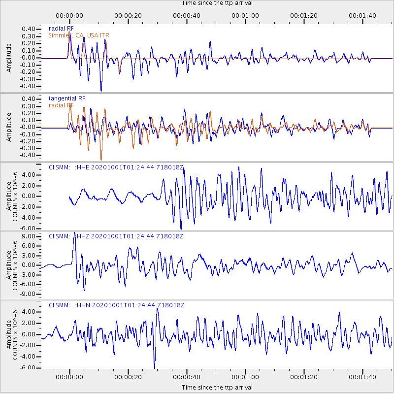
SMM Simmler, CA, USA - Earthquake Result Viewer
*The percent match for this event was below the threshold and hence no stack was calculated.
| Earthquake location: |
Tonga Islands |
| Earthquake latitude/longitude: |
-19.1/-173.6 |
| Earthquake time(UTC): |
2020/10/01 (275) 01:13:39 GMT |
| Earthquake Depth: |
10 km |
| Earthquake Magnitude: |
6.7 Mi |
| Earthquake Catalog/Contributor: |
NEIC PDE/at |
|
| Network: |
CI Caltech Regional Seismic Network |
| Station: |
SMM Simmler, CA, USA |
| Lat/Lon: |
35.31 N/120.00 W |
| Elevation: |
599 m |
|
| Distance: |
74.2 deg |
| Az: |
43.159 deg |
| Baz: |
232.272 deg |
| Ray Param: |
$rayparam |
*The percent match for this event was below the threshold and hence was not used in the summary stack. |
|
| Radial Match: |
87.477776 % |
| Radial Bump: |
400 |
| Transverse Match: |
80.153015 % |
| Transverse Bump: |
400 |
| SOD ConfigId: |
22732711 |
| Insert Time: |
2020-10-15 01:27:04.395 +0000 |
| GWidth: |
2.5 |
| Max Bumps: |
400 |
| Tol: |
0.001 |
|
Signal To Noise
| Channel | StoN | STA | LTA |
| CI:SMM: :HHZ:20201001T01:24:44.718018Z | 11.024246 | 4.3609425E-6 | 3.955774E-7 |
| CI:SMM: :HHN:20201001T01:24:44.718018Z | 2.7110233 | 1.0469356E-6 | 3.8617728E-7 |
| CI:SMM: :HHE:20201001T01:24:44.718018Z | 1.7353373 | 1.3065795E-6 | 7.529254E-7 |
| Arrivals |
| Ps | |
| PpPs | |
| PsPs/PpSs | |


