You are here: Home > Network List > IU - Global Seismograph Network (GSN - IRIS/USGS) Stations List
> Station PMG Port Moresby, New Guinea > Earthquake Result Viewer
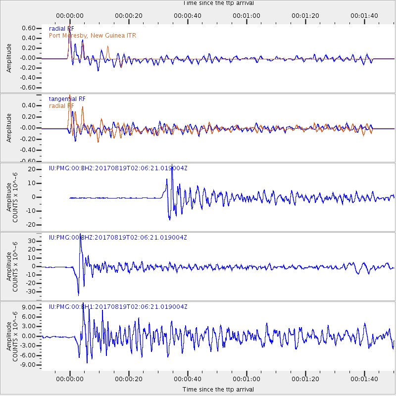
PMG Port Moresby, New Guinea - Earthquake Result Viewer
*The percent match for this event was below the threshold and hence no stack was calculated.
| Earthquake location: |
Fiji Islands Region |
| Earthquake latitude/longitude: |
-18.0/-178.9 |
| Earthquake time(UTC): |
2017/08/19 (231) 02:00:52 GMT |
| Earthquake Depth: |
539 km |
| Earthquake Magnitude: |
6.4 Mww |
| Earthquake Catalog/Contributor: |
NEIC PDE/us |
|
| Network: |
IU Global Seismograph Network (GSN - IRIS/USGS) |
| Station: |
PMG Port Moresby, New Guinea |
| Lat/Lon: |
9.40 S/147.16 E |
| Elevation: |
90 m |
|
| Distance: |
34.1 deg |
| Az: |
279.902 deg |
| Baz: |
108.144 deg |
| Ray Param: |
$rayparam |
*The percent match for this event was below the threshold and hence was not used in the summary stack. |
|
| Radial Match: |
92.54847 % |
| Radial Bump: |
400 |
| Transverse Match: |
85.04144 % |
| Transverse Bump: |
400 |
| SOD ConfigId: |
2140511 |
| Insert Time: |
2017-09-01 17:59:18.460 +0000 |
| GWidth: |
2.5 |
| Max Bumps: |
400 |
| Tol: |
0.001 |
|
Signal To Noise
| Channel | StoN | STA | LTA |
| IU:PMG:00:BHZ:20170819T02:06:21.019004Z | 126.44512 | 1.5181144E-5 | 1.2006113E-7 |
| IU:PMG:00:BH1:20170819T02:06:21.019004Z | 20.674276 | 3.0577512E-6 | 1.4790123E-7 |
| IU:PMG:00:BH2:20170819T02:06:21.019004Z | 89.8588 | 8.547805E-6 | 9.512484E-8 |
| Arrivals |
| Ps | |
| PpPs | |
| PsPs/PpSs | |


