You are here: Home > Network List > IU - Global Seismograph Network (GSN - IRIS/USGS) Stations List
> Station POHA Pohakuloa, Hawaii, USA > Earthquake Result Viewer
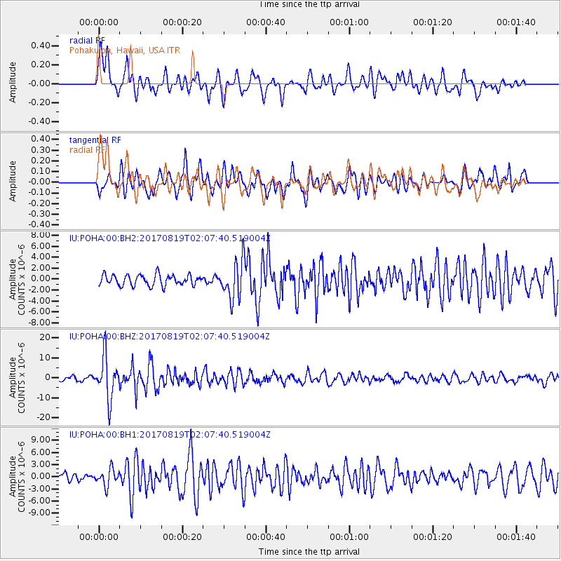
POHA Pohakuloa, Hawaii, USA - Earthquake Result Viewer
*The percent match for this event was below the threshold and hence no stack was calculated.
| Earthquake location: |
Fiji Islands Region |
| Earthquake latitude/longitude: |
-18.0/-178.9 |
| Earthquake time(UTC): |
2017/08/19 (231) 02:00:52 GMT |
| Earthquake Depth: |
539 km |
| Earthquake Magnitude: |
6.4 Mww |
| Earthquake Catalog/Contributor: |
NEIC PDE/us |
|
| Network: |
IU Global Seismograph Network (GSN - IRIS/USGS) |
| Station: |
POHA Pohakuloa, Hawaii, USA |
| Lat/Lon: |
19.76 N/155.53 W |
| Elevation: |
1990 m |
|
| Distance: |
43.9 deg |
| Az: |
32.508 deg |
| Baz: |
212.897 deg |
| Ray Param: |
$rayparam |
*The percent match for this event was below the threshold and hence was not used in the summary stack. |
|
| Radial Match: |
79.002975 % |
| Radial Bump: |
400 |
| Transverse Match: |
71.06359 % |
| Transverse Bump: |
400 |
| SOD ConfigId: |
2140511 |
| Insert Time: |
2017-09-01 17:59:21.914 +0000 |
| GWidth: |
2.5 |
| Max Bumps: |
400 |
| Tol: |
0.001 |
|
Signal To Noise
| Channel | StoN | STA | LTA |
| IU:POHA:00:BHZ:20170819T02:07:40.519004Z | 12.818904 | 1.0779487E-5 | 8.4090556E-7 |
| IU:POHA:00:BH1:20170819T02:07:40.519004Z | 1.8623123 | 2.0866942E-6 | 1.1204856E-6 |
| IU:POHA:00:BH2:20170819T02:07:40.519004Z | 3.6483266 | 3.551007E-6 | 9.733249E-7 |
| Arrivals |
| Ps | |
| PpPs | |
| PsPs/PpSs | |


