You are here: Home > Network List > US - United States National Seismic Network Stations List
> Station EGMT Eagleton, Montana, USA > Earthquake Result Viewer
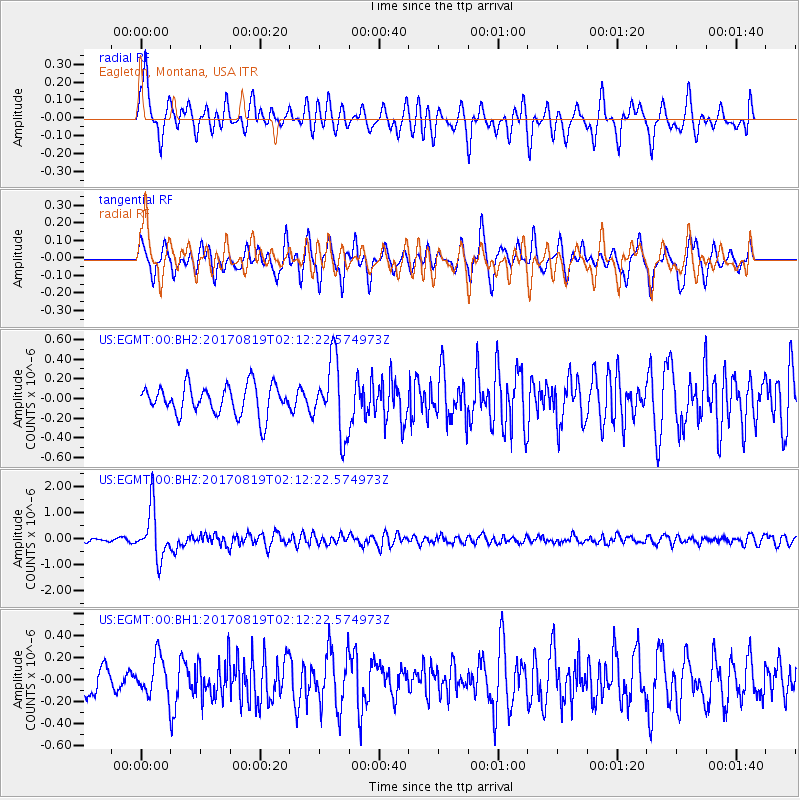
EGMT Eagleton, Montana, USA - Earthquake Result Viewer
*The percent match for this event was below the threshold and hence no stack was calculated.
| Earthquake location: |
Fiji Islands Region |
| Earthquake latitude/longitude: |
-18.0/-178.9 |
| Earthquake time(UTC): |
2017/08/19 (231) 02:00:52 GMT |
| Earthquake Depth: |
539 km |
| Earthquake Magnitude: |
6.4 Mww |
| Earthquake Catalog/Contributor: |
NEIC PDE/us |
|
| Network: |
US United States National Seismic Network |
| Station: |
EGMT Eagleton, Montana, USA |
| Lat/Lon: |
48.02 N/109.75 W |
| Elevation: |
1055 m |
|
| Distance: |
90.0 deg |
| Az: |
38.837 deg |
| Baz: |
242.772 deg |
| Ray Param: |
$rayparam |
*The percent match for this event was below the threshold and hence was not used in the summary stack. |
|
| Radial Match: |
66.50127 % |
| Radial Bump: |
400 |
| Transverse Match: |
70.76378 % |
| Transverse Bump: |
400 |
| SOD ConfigId: |
2140511 |
| Insert Time: |
2017-09-01 18:00:32.937 +0000 |
| GWidth: |
2.5 |
| Max Bumps: |
400 |
| Tol: |
0.001 |
|
Signal To Noise
| Channel | StoN | STA | LTA |
| US:EGMT:00:BHZ:20170819T02:12:22.574973Z | 14.006938 | 9.569528E-7 | 6.831991E-8 |
| US:EGMT:00:BH1:20170819T02:12:22.574973Z | 1.3261907 | 1.7263983E-7 | 1.3017723E-7 |
| US:EGMT:00:BH2:20170819T02:12:22.574973Z | 2.4898653 | 3.7554048E-7 | 1.5082763E-7 |
| Arrivals |
| Ps | |
| PpPs | |
| PsPs/PpSs | |


