You are here: Home > Network List > TA - USArray Transportable Network (new EarthScope stations) Stations List
> Station D23K Nanushuk River, AK USA > Earthquake Result Viewer
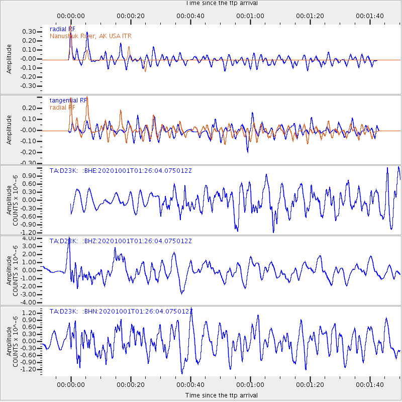
D23K Nanushuk River, AK USA - Earthquake Result Viewer
*The percent match for this event was below the threshold and hence no stack was calculated.
| Earthquake location: |
Tonga Islands |
| Earthquake latitude/longitude: |
-19.1/-173.6 |
| Earthquake time(UTC): |
2020/10/01 (275) 01:13:39 GMT |
| Earthquake Depth: |
10 km |
| Earthquake Magnitude: |
6.7 Mi |
| Earthquake Catalog/Contributor: |
NEIC PDE/at |
|
| Network: |
TA USArray Transportable Network (new EarthScope stations) |
| Station: |
D23K Nanushuk River, AK USA |
| Lat/Lon: |
68.97 N/150.68 W |
| Elevation: |
406 m |
|
| Distance: |
89.4 deg |
| Az: |
8.083 deg |
| Baz: |
201.61 deg |
| Ray Param: |
$rayparam |
*The percent match for this event was below the threshold and hence was not used in the summary stack. |
|
| Radial Match: |
76.589905 % |
| Radial Bump: |
400 |
| Transverse Match: |
69.52193 % |
| Transverse Bump: |
400 |
| SOD ConfigId: |
22732711 |
| Insert Time: |
2020-10-15 01:39:16.725 +0000 |
| GWidth: |
2.5 |
| Max Bumps: |
400 |
| Tol: |
0.001 |
|
Signal To Noise
| Channel | StoN | STA | LTA |
| TA:D23K: :BHZ:20201001T01:26:04.075012Z | 3.1983452 | 1.5053263E-6 | 4.7065788E-7 |
| TA:D23K: :BHN:20201001T01:26:04.075012Z | 2.6560178 | 5.4501356E-7 | 2.0519953E-7 |
| TA:D23K: :BHE:20201001T01:26:04.075012Z | 1.1417981 | 2.7680687E-7 | 2.4243064E-7 |
| Arrivals |
| Ps | |
| PpPs | |
| PsPs/PpSs | |


