You are here: Home > Network List > TA - USArray Transportable Network (new EarthScope stations) Stations List
> Station R33M Jennings River, BC, CAN > Earthquake Result Viewer
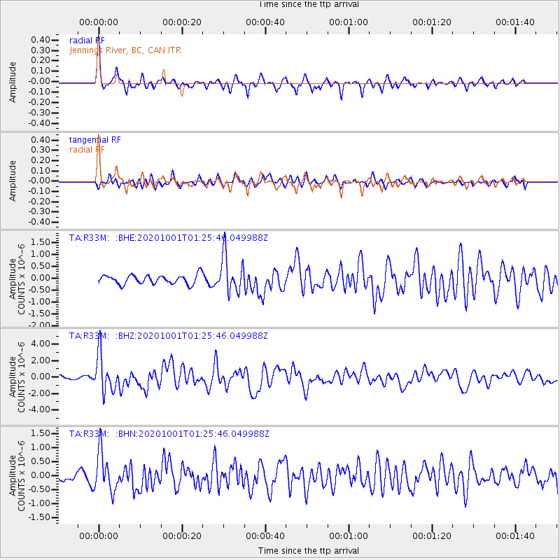
R33M Jennings River, BC, CAN - Earthquake Result Viewer
*The percent match for this event was below the threshold and hence no stack was calculated.
| Earthquake location: |
Tonga Islands |
| Earthquake latitude/longitude: |
-19.1/-173.6 |
| Earthquake time(UTC): |
2020/10/01 (275) 01:13:39 GMT |
| Earthquake Depth: |
10 km |
| Earthquake Magnitude: |
6.7 Mi |
| Earthquake Catalog/Contributor: |
NEIC PDE/at |
|
| Network: |
TA USArray Transportable Network (new EarthScope stations) |
| Station: |
R33M Jennings River, BC, CAN |
| Lat/Lon: |
59.39 N/130.97 W |
| Elevation: |
1437 m |
|
| Distance: |
85.6 deg |
| Az: |
20.338 deg |
| Baz: |
219.967 deg |
| Ray Param: |
$rayparam |
*The percent match for this event was below the threshold and hence was not used in the summary stack. |
|
| Radial Match: |
79.24114 % |
| Radial Bump: |
342 |
| Transverse Match: |
63.819767 % |
| Transverse Bump: |
400 |
| SOD ConfigId: |
22732711 |
| Insert Time: |
2020-10-15 01:41:04.878 +0000 |
| GWidth: |
2.5 |
| Max Bumps: |
400 |
| Tol: |
0.001 |
|
Signal To Noise
| Channel | StoN | STA | LTA |
| TA:R33M: :BHZ:20201001T01:25:46.049988Z | 8.98532 | 2.3003543E-6 | 2.5601253E-7 |
| TA:R33M: :BHN:20201001T01:25:46.049988Z | 4.548759 | 7.1830374E-7 | 1.5791204E-7 |
| TA:R33M: :BHE:20201001T01:25:46.049988Z | 4.218471 | 8.01987E-7 | 1.901132E-7 |
| Arrivals |
| Ps | |
| PpPs | |
| PsPs/PpSs | |


