You are here: Home > Network List > US - United States National Seismic Network Stations List
> Station DGMT Dagmar, Montana, USA > Earthquake Result Viewer
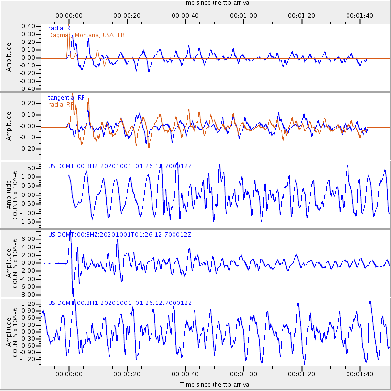
DGMT Dagmar, Montana, USA - Earthquake Result Viewer
*The percent match for this event was below the threshold and hence no stack was calculated.
| Earthquake location: |
Tonga Islands |
| Earthquake latitude/longitude: |
-19.1/-173.6 |
| Earthquake time(UTC): |
2020/10/01 (275) 01:13:39 GMT |
| Earthquake Depth: |
10 km |
| Earthquake Magnitude: |
6.7 Mi |
| Earthquake Catalog/Contributor: |
NEIC PDE/at |
|
| Network: |
US United States National Seismic Network |
| Station: |
DGMT Dagmar, Montana, USA |
| Lat/Lon: |
48.47 N/104.20 W |
| Elevation: |
0.0 m |
|
| Distance: |
91.2 deg |
| Az: |
38.544 deg |
| Baz: |
242.3 deg |
| Ray Param: |
$rayparam |
*The percent match for this event was below the threshold and hence was not used in the summary stack. |
|
| Radial Match: |
58.204975 % |
| Radial Bump: |
333 |
| Transverse Match: |
65.56624 % |
| Transverse Bump: |
400 |
| SOD ConfigId: |
22732711 |
| Insert Time: |
2020-10-15 01:44:40.361 +0000 |
| GWidth: |
2.5 |
| Max Bumps: |
400 |
| Tol: |
0.001 |
|
Signal To Noise
| Channel | StoN | STA | LTA |
| US:DGMT:00:BHZ:20201001T01:26:12.700012Z | 21.994951 | 4.1118715E-6 | 1.8694615E-7 |
| US:DGMT:00:BH1:20201001T01:26:12.700012Z | 1.4997565 | 8.0613955E-7 | 5.3751364E-7 |
| US:DGMT:00:BH2:20201001T01:26:12.700012Z | 1.410301 | 9.753853E-7 | 6.91615E-7 |
| Arrivals |
| Ps | |
| PpPs | |
| PsPs/PpSs | |


