You are here: Home > Network List > WY - Yellowstone Wyoming Seismic Network Stations List
> Station YPP Pitchstone Plateau, YNP, WY, USA > Earthquake Result Viewer
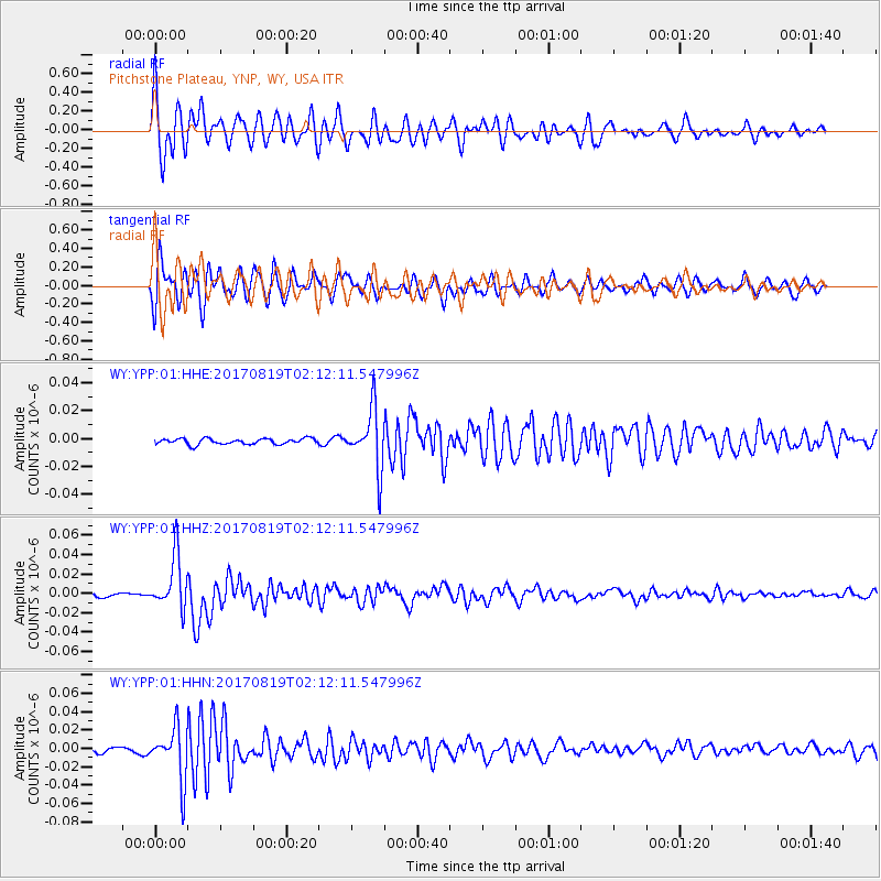
YPP Pitchstone Plateau, YNP, WY, USA - Earthquake Result Viewer
*The percent match for this event was below the threshold and hence no stack was calculated.
| Earthquake location: |
Fiji Islands Region |
| Earthquake latitude/longitude: |
-18.0/-178.9 |
| Earthquake time(UTC): |
2017/08/19 (231) 02:00:52 GMT |
| Earthquake Depth: |
539 km |
| Earthquake Magnitude: |
6.4 Mww |
| Earthquake Catalog/Contributor: |
NEIC PDE/us |
|
| Network: |
WY Yellowstone Wyoming Seismic Network |
| Station: |
YPP Pitchstone Plateau, YNP, WY, USA |
| Lat/Lon: |
44.27 N/110.80 W |
| Elevation: |
2707 m |
|
| Distance: |
87.6 deg |
| Az: |
41.827 deg |
| Baz: |
242.082 deg |
| Ray Param: |
$rayparam |
*The percent match for this event was below the threshold and hence was not used in the summary stack. |
|
| Radial Match: |
75.17428 % |
| Radial Bump: |
400 |
| Transverse Match: |
75.04349 % |
| Transverse Bump: |
400 |
| SOD ConfigId: |
2140511 |
| Insert Time: |
2017-09-01 18:02:45.332 +0000 |
| GWidth: |
2.5 |
| Max Bumps: |
400 |
| Tol: |
0.001 |
|
Signal To Noise
| Channel | StoN | STA | LTA |
| WY:YPP:01:HHZ:20170819T02:12:11.547996Z | 11.022585 | 2.7340253E-8 | 2.4803848E-9 |
| WY:YPP:01:HHN:20170819T02:12:11.547996Z | 10.51189 | 2.8620457E-8 | 2.7226748E-9 |
| WY:YPP:01:HHE:20170819T02:12:11.547996Z | 10.147412 | 2.1029104E-8 | 2.0723612E-9 |
| Arrivals |
| Ps | |
| PpPs | |
| PsPs/PpSs | |


