You are here: Home > Network List > CI - Caltech Regional Seismic Network Stations List
> Station MPP McPhearson Peak > Earthquake Result Viewer
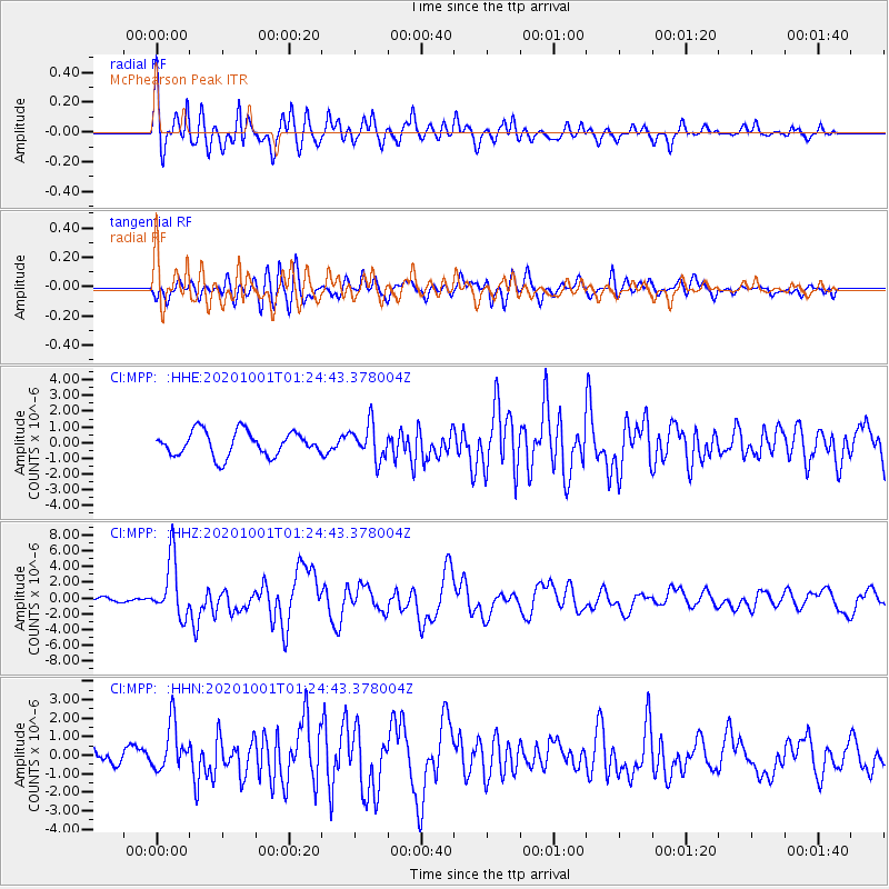
MPP McPhearson Peak - Earthquake Result Viewer
*The percent match for this event was below the threshold and hence no stack was calculated.
| Earthquake location: |
Tonga Islands |
| Earthquake latitude/longitude: |
-19.5/-174.2 |
| Earthquake time(UTC): |
2020/10/01 (275) 01:13:37 GMT |
| Earthquake Depth: |
35 km |
| Earthquake Magnitude: |
6.4 Mww |
| Earthquake Catalog/Contributor: |
NEIC PDE/us |
|
| Network: |
CI Caltech Regional Seismic Network |
| Station: |
MPP McPhearson Peak |
| Lat/Lon: |
34.89 N/119.81 W |
| Elevation: |
1739 m |
|
| Distance: |
74.8 deg |
| Az: |
43.852 deg |
| Baz: |
232.658 deg |
| Ray Param: |
$rayparam |
*The percent match for this event was below the threshold and hence was not used in the summary stack. |
|
| Radial Match: |
79.62774 % |
| Radial Bump: |
400 |
| Transverse Match: |
75.43492 % |
| Transverse Bump: |
400 |
| SOD ConfigId: |
22732711 |
| Insert Time: |
2020-10-15 02:00:40.904 +0000 |
| GWidth: |
2.5 |
| Max Bumps: |
400 |
| Tol: |
0.001 |
|
Signal To Noise
| Channel | StoN | STA | LTA |
| CI:MPP: :HHZ:20201001T01:24:43.378004Z | 14.345645 | 3.7172376E-6 | 2.591196E-7 |
| CI:MPP: :HHN:20201001T01:24:43.378004Z | 2.8882792 | 1.2633975E-6 | 4.374222E-7 |
| CI:MPP: :HHE:20201001T01:24:43.378004Z | 1.4182997 | 1.106622E-6 | 7.8024556E-7 |
| Arrivals |
| Ps | |
| PpPs | |
| PsPs/PpSs | |


