You are here: Home > Network List > CI - Caltech Regional Seismic Network Stations List
> Station SMM Simmler, CA, USA > Earthquake Result Viewer
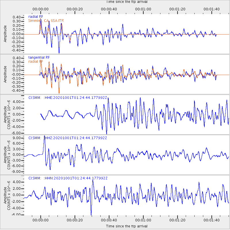
SMM Simmler, CA, USA - Earthquake Result Viewer
*The percent match for this event was below the threshold and hence no stack was calculated.
| Earthquake location: |
Tonga Islands |
| Earthquake latitude/longitude: |
-19.5/-174.2 |
| Earthquake time(UTC): |
2020/10/01 (275) 01:13:37 GMT |
| Earthquake Depth: |
35 km |
| Earthquake Magnitude: |
6.4 Mww |
| Earthquake Catalog/Contributor: |
NEIC PDE/us |
|
| Network: |
CI Caltech Regional Seismic Network |
| Station: |
SMM Simmler, CA, USA |
| Lat/Lon: |
35.31 N/120.00 W |
| Elevation: |
599 m |
|
| Distance: |
74.9 deg |
| Az: |
43.409 deg |
| Baz: |
232.438 deg |
| Ray Param: |
$rayparam |
*The percent match for this event was below the threshold and hence was not used in the summary stack. |
|
| Radial Match: |
87.62146 % |
| Radial Bump: |
400 |
| Transverse Match: |
80.07567 % |
| Transverse Bump: |
400 |
| SOD ConfigId: |
22732711 |
| Insert Time: |
2020-10-15 02:01:10.285 +0000 |
| GWidth: |
2.5 |
| Max Bumps: |
400 |
| Tol: |
0.001 |
|
Signal To Noise
| Channel | StoN | STA | LTA |
| CI:SMM: :HHZ:20201001T01:24:44.177992Z | 10.620102 | 4.211222E-6 | 3.9653312E-7 |
| CI:SMM: :HHN:20201001T01:24:44.177992Z | 2.877756 | 1.0813644E-6 | 3.7576655E-7 |
| CI:SMM: :HHE:20201001T01:24:44.177992Z | 1.7107972 | 1.2707334E-6 | 7.4277267E-7 |
| Arrivals |
| Ps | |
| PpPs | |
| PsPs/PpSs | |


