You are here: Home > Network List > GM - US Geological Survey Networks Stations List
> Station IWM01 Jericho 2M Well Monitoring Station > Earthquake Result Viewer
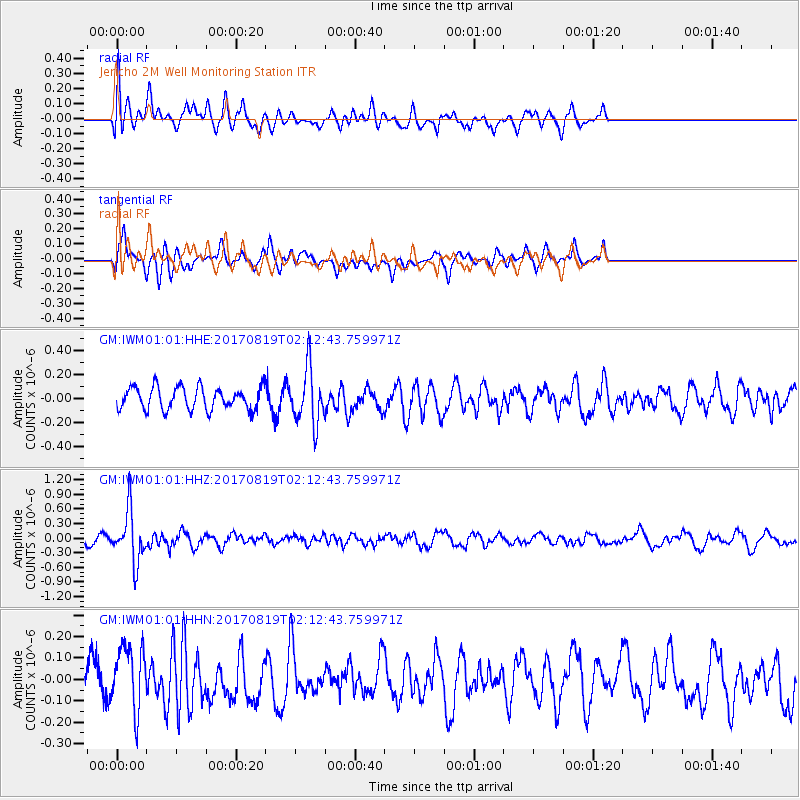
IWM01 Jericho 2M Well Monitoring Station - Earthquake Result Viewer
*The percent match for this event was below the threshold and hence no stack was calculated.
| Earthquake location: |
Fiji Islands Region |
| Earthquake latitude/longitude: |
-18.0/-178.9 |
| Earthquake time(UTC): |
2017/08/19 (231) 02:00:52 GMT |
| Earthquake Depth: |
539 km |
| Earthquake Magnitude: |
6.4 Mww |
| Earthquake Catalog/Contributor: |
NEIC PDE/us |
|
| Network: |
GM US Geological Survey Networks |
| Station: |
IWM01 Jericho 2M Well Monitoring Station |
| Lat/Lon: |
36.73 N/96.53 W |
| Elevation: |
328 m |
|
| Distance: |
94.6 deg |
| Az: |
53.014 deg |
| Baz: |
251.149 deg |
| Ray Param: |
$rayparam |
*The percent match for this event was below the threshold and hence was not used in the summary stack. |
|
| Radial Match: |
55.970062 % |
| Radial Bump: |
400 |
| Transverse Match: |
51.950596 % |
| Transverse Bump: |
349 |
| SOD ConfigId: |
2140511 |
| Insert Time: |
2017-09-01 18:04:28.840 +0000 |
| GWidth: |
2.5 |
| Max Bumps: |
400 |
| Tol: |
0.001 |
|
Signal To Noise
| Channel | StoN | STA | LTA |
| GM:IWM01:01:HHZ:20170819T02:12:43.759971Z | 6.0218997 | 5.242227E-7 | 8.705271E-8 |
| GM:IWM01:01:HHN:20170819T02:12:43.759971Z | 2.226065 | 1.5147674E-7 | 6.8046866E-8 |
| GM:IWM01:01:HHE:20170819T02:12:43.759971Z | 2.520431 | 2.3102832E-7 | 9.166223E-8 |
| Arrivals |
| Ps | |
| PpPs | |
| PsPs/PpSs | |


