You are here: Home > Network List > GS - US Geological Survey Networks Stations List
> Station DEC08 Decatur Surface Seismic Site, Decatur, IL, USA > Earthquake Result Viewer
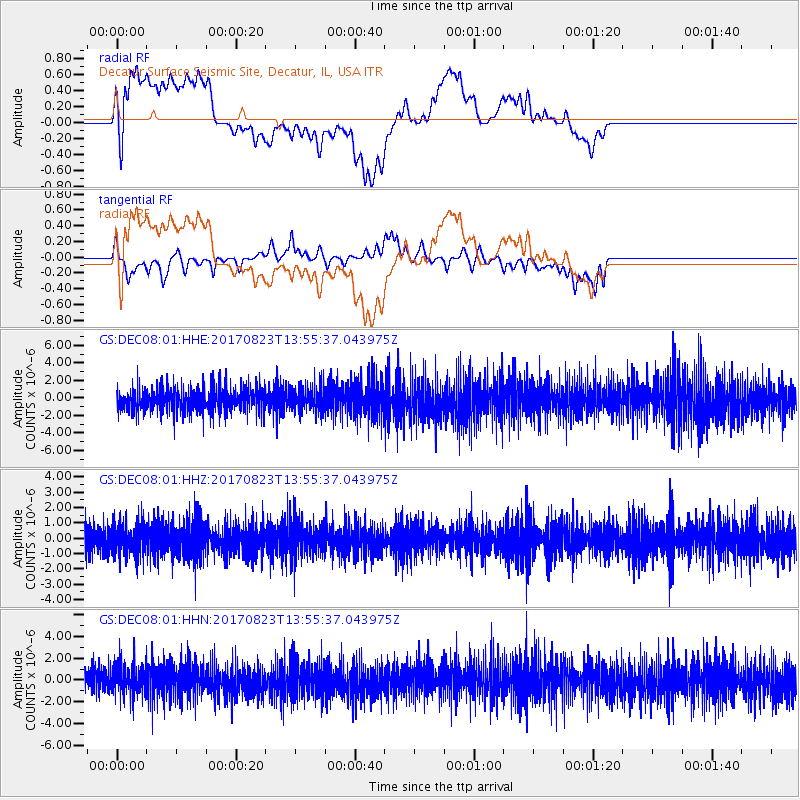
DEC08 Decatur Surface Seismic Site, Decatur, IL, USA - Earthquake Result Viewer
*The percent match for this event was below the threshold and hence no stack was calculated.
| Earthquake location: |
Iran-Iraq Border Region |
| Earthquake latitude/longitude: |
36.2/45.0 |
| Earthquake time(UTC): |
2017/08/23 (235) 13:42:53 GMT |
| Earthquake Depth: |
10 km |
| Earthquake Magnitude: |
5.6 mb |
| Earthquake Catalog/Contributor: |
NEIC PDE/us |
|
| Network: |
GS US Geological Survey Networks |
| Station: |
DEC08 Decatur Surface Seismic Site, Decatur, IL, USA |
| Lat/Lon: |
39.86 N/88.92 W |
| Elevation: |
210 m |
|
| Distance: |
93.3 deg |
| Az: |
326.252 deg |
| Baz: |
35.741 deg |
| Ray Param: |
$rayparam |
*The percent match for this event was below the threshold and hence was not used in the summary stack. |
|
| Radial Match: |
43.79727 % |
| Radial Bump: |
400 |
| Transverse Match: |
44.133312 % |
| Transverse Bump: |
400 |
| SOD ConfigId: |
2140511 |
| Insert Time: |
2017-09-06 05:35:49.053 +0000 |
| GWidth: |
2.5 |
| Max Bumps: |
400 |
| Tol: |
0.001 |
|
Signal To Noise
| Channel | StoN | STA | LTA |
| GS:DEC08:01:HHZ:20170823T13:55:37.043975Z | 1.1335937 | 1.0218707E-6 | 9.0144357E-7 |
| GS:DEC08:01:HHN:20170823T13:55:37.043975Z | 1.1243622 | 1.3529162E-6 | 1.2032743E-6 |
| GS:DEC08:01:HHE:20170823T13:55:37.043975Z | 1.0208025 | 1.3756196E-6 | 1.3475865E-6 |
| Arrivals |
| Ps | |
| PpPs | |
| PsPs/PpSs | |


