JWM XT.JWM - Earthquake Result Viewer
Earthquake location: Peru-Brazil Border Region
Earthquake latitude/longitude: -8.1/-74.2
Earthquake time(UTC): 1998/04/03 (093) 22:01:48 GMT
Earthquake Depth: 165 km
Earthquake Magnitude: 6.1 MB, 5.6 MS, 6.6 UNKNOWN, 6.6 MW
Earthquake Catalog/Contributor: WHDF/NEIC
Network: XT Colorado BB Array - Lodore
Station: JWM XT.JWM
Lat/Lon: 40.57 N/108.60 W
Elevation: 2077 m
Distance: 57.9 deg
Az: 329.499 deg
Baz: 138.726 deg
Ray Param: 0.06266442
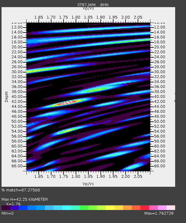
Estimated Moho Depth: 42.25 km
Estimated Crust Vp/Vs: 1.76
Assumed Crust Vp: 6.207 km/s
Estimated Crust Vs: 3.527 km/s
Estimated Crust Poisson's Ratio: 0.26
Radial Match: 87.27588 %
Radial Bump: 400
Transverse Match: 79.2519 %
Transverse Bump: 400
SOD ConfigId: 4480
Insert Time: 2010-03-09 01:36:06.424 +0000
GWidth: 2.5
Max Bumps: 400
Tol: 0.001

Signal To Noise

ChannelStoNSTALTA
XT:JWM: :BHN:19980403T22:10:52.249011Z7.37263156.052805E-78.2098296E-8
XT:JWM: :BHE:19980403T22:10:52.249011Z2.79400253.2232956E-71.1536481E-7
XT:JWM: :BHZ:19980403T22:10:52.249011Z1.03280391.6413887E-71.5892549E-7
Arrivals
Ps5.4 SECOND
PpPs18 SECOND
PsPs/PpSs23 SECOND