You are here: Home > Network List > TA - USArray Transportable Network (new EarthScope stations) Stations List
> Station F26K Sheenjek River, AK, USA > Earthquake Result Viewer
F26K Sheenjek River, AK, USA - Earthquake Result Viewer

| Earthquake location: |
Tonga Islands |
| Earthquake latitude/longitude: |
-19.5/-174.2 |
| Earthquake time(UTC): |
2020/10/01 (275) 01:13:37 GMT |
| Earthquake Depth: |
35 km |
| Earthquake Magnitude: |
6.4 Mww |
| Earthquake Catalog/Contributor: |
NEIC PDE/us |
|
| Network: |
TA USArray Transportable Network (new EarthScope stations) |
| Station: |
F26K Sheenjek River, AK, USA |
| Lat/Lon: |
67.69 N/144.15 W |
| Elevation: |
683 m |
|
| Distance: |
89.7 deg |
| Az: |
11.03 deg |
| Baz: |
208.218 deg |
| Ray Param: |
0.04173181 |
| Estimated Moho Depth: |
35.75 km |
| Estimated Crust Vp/Vs: |
1.69 |
| Assumed Crust Vp: |
6.522 km/s |
| Estimated Crust Vs: |
3.87 km/s |
| Estimated Crust Poisson's Ratio: |
0.23 |
|
| Radial Match: |
87.48333 % |
| Radial Bump: |
348 |
| Transverse Match: |
65.754555 % |
| Transverse Bump: |
394 |
| SOD ConfigId: |
22732711 |
| Insert Time: |
2020-10-15 02:13:43.690 +0000 |
| GWidth: |
2.5 |
| Max Bumps: |
400 |
| Tol: |
0.001 |
|
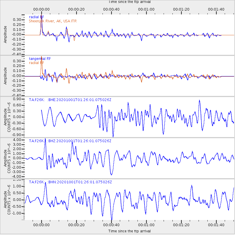
Signal To Noise
| Channel | StoN | STA | LTA |
| TA:F26K: :BHZ:20201001T01:26:01.075026Z | 10.85683 | 1.6416269E-6 | 1.5120683E-7 |
| TA:F26K: :BHN:20201001T01:26:01.075026Z | 3.5517995 | 5.4170636E-7 | 1.5251604E-7 |
| TA:F26K: :BHE:20201001T01:26:01.075026Z | 1.529791 | 3.398929E-7 | 2.2218258E-7 |
| Arrivals |
| Ps | 3.8 SECOND |
| PpPs | 14 SECOND |
| PsPs/PpSs | 18 SECOND |


