You are here: Home > Network List > PF - Volcanologic Network of Piton de Fournaise-OVPF Stations List
> Station HIM cratere Himiltrude > Earthquake Result Viewer
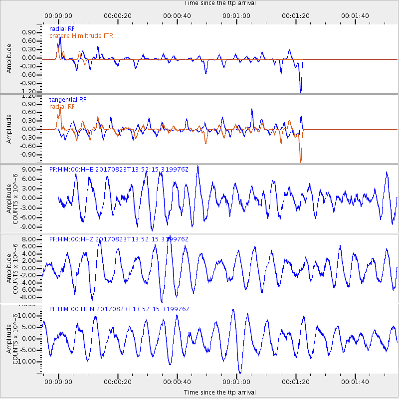
HIM cratere Himiltrude - Earthquake Result Viewer
*The percent match for this event was below the threshold and hence no stack was calculated.
| Earthquake location: |
Iran-Iraq Border Region |
| Earthquake latitude/longitude: |
36.2/45.0 |
| Earthquake time(UTC): |
2017/08/23 (235) 13:42:53 GMT |
| Earthquake Depth: |
10 km |
| Earthquake Magnitude: |
5.6 mb |
| Earthquake Catalog/Contributor: |
NEIC PDE/us |
|
| Network: |
PF Volcanologic Network of Piton de Fournaise-OVPF |
| Station: |
HIM cratere Himiltrude |
| Lat/Lon: |
21.21 S/55.72 E |
| Elevation: |
1958 m |
|
| Distance: |
58.0 deg |
| Az: |
168.154 deg |
| Baz: |
349.744 deg |
| Ray Param: |
$rayparam |
*The percent match for this event was below the threshold and hence was not used in the summary stack. |
|
| Radial Match: |
78.44677 % |
| Radial Bump: |
400 |
| Transverse Match: |
68.90742 % |
| Transverse Bump: |
400 |
| SOD ConfigId: |
2140511 |
| Insert Time: |
2017-09-06 05:39:29.381 +0000 |
| GWidth: |
2.5 |
| Max Bumps: |
400 |
| Tol: |
0.001 |
|
Signal To Noise
| Channel | StoN | STA | LTA |
| PF:HIM:00:HHZ:20170823T13:52:15.319976Z | 0.93464464 | 2.2020608E-6 | 2.3560406E-6 |
| PF:HIM:00:HHN:20170823T13:52:15.319976Z | 0.6806821 | 2.8058332E-6 | 4.1220906E-6 |
| PF:HIM:00:HHE:20170823T13:52:15.319976Z | 1.8342209 | 6.4810088E-6 | 3.5333853E-6 |
| Arrivals |
| Ps | |
| PpPs | |
| PsPs/PpSs | |


