You are here: Home > Network List > TA - USArray Transportable Network (new EarthScope stations) Stations List
> Station R33M Jennings River, BC, CAN > Earthquake Result Viewer
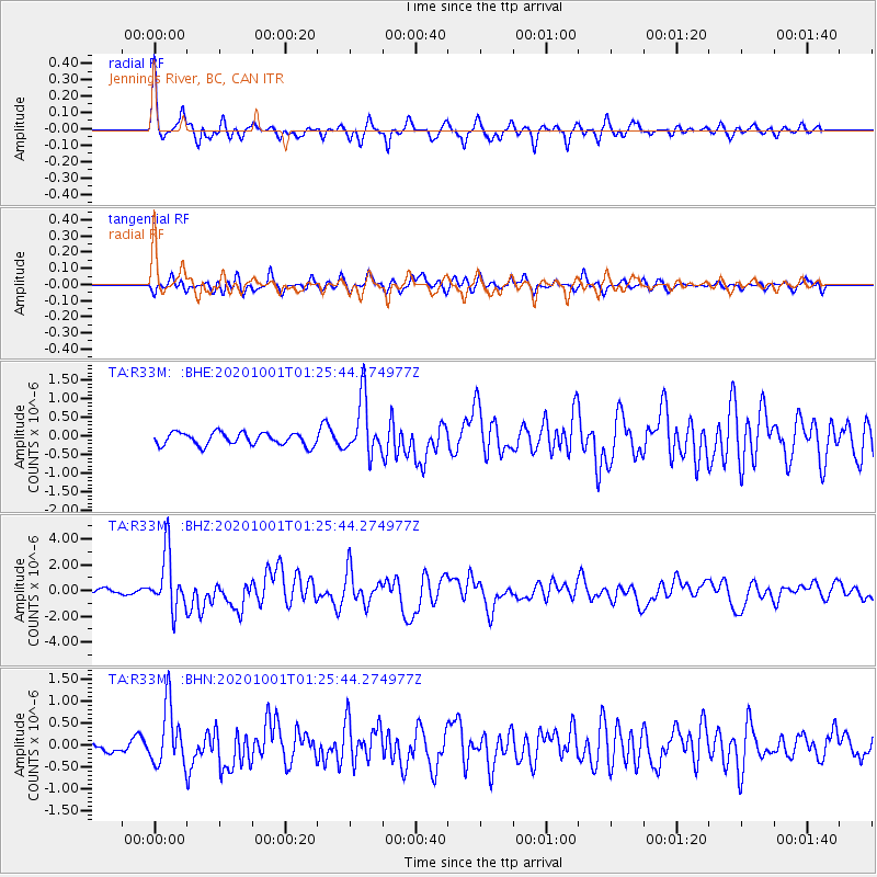
R33M Jennings River, BC, CAN - Earthquake Result Viewer
*The percent match for this event was below the threshold and hence no stack was calculated.
| Earthquake location: |
Tonga Islands |
| Earthquake latitude/longitude: |
-19.5/-174.2 |
| Earthquake time(UTC): |
2020/10/01 (275) 01:13:37 GMT |
| Earthquake Depth: |
35 km |
| Earthquake Magnitude: |
6.4 Mww |
| Earthquake Catalog/Contributor: |
NEIC PDE/us |
|
| Network: |
TA USArray Transportable Network (new EarthScope stations) |
| Station: |
R33M Jennings River, BC, CAN |
| Lat/Lon: |
59.39 N/130.97 W |
| Elevation: |
1437 m |
|
| Distance: |
86.2 deg |
| Az: |
20.574 deg |
| Baz: |
220.384 deg |
| Ray Param: |
$rayparam |
*The percent match for this event was below the threshold and hence was not used in the summary stack. |
|
| Radial Match: |
79.43697 % |
| Radial Bump: |
325 |
| Transverse Match: |
64.26604 % |
| Transverse Bump: |
400 |
| SOD ConfigId: |
22732711 |
| Insert Time: |
2020-10-15 02:15:05.018 +0000 |
| GWidth: |
2.5 |
| Max Bumps: |
400 |
| Tol: |
0.001 |
|
Signal To Noise
| Channel | StoN | STA | LTA |
| TA:R33M: :BHZ:20201001T01:25:44.274977Z | 8.738353 | 2.1920878E-6 | 2.5085825E-7 |
| TA:R33M: :BHN:20201001T01:25:44.274977Z | 4.2869344 | 6.84201E-7 | 1.5960146E-7 |
| TA:R33M: :BHE:20201001T01:25:44.274977Z | 4.4841347 | 7.517192E-7 | 1.6763975E-7 |
| Arrivals |
| Ps | |
| PpPs | |
| PsPs/PpSs | |


