You are here: Home > Network List > G - GEOSCOPE Stations List
> Station INU Inuyama, Japan > Earthquake Result Viewer
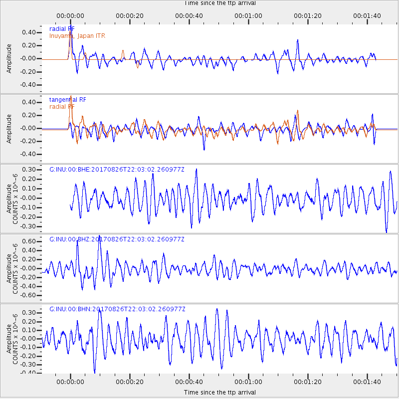
INU Inuyama, Japan - Earthquake Result Viewer
*The percent match for this event was below the threshold and hence no stack was calculated.
| Earthquake location: |
North Of Macquarie Island |
| Earthquake latitude/longitude: |
-47.3/160.0 |
| Earthquake time(UTC): |
2017/08/26 (238) 21:50:59 GMT |
| Earthquake Depth: |
10 km |
| Earthquake Magnitude: |
5.5 Mww |
| Earthquake Catalog/Contributor: |
NEIC PDE/us |
|
| Network: |
G GEOSCOPE |
| Station: |
INU Inuyama, Japan |
| Lat/Lon: |
35.35 N/137.03 E |
| Elevation: |
132 m |
|
| Distance: |
84.8 deg |
| Az: |
341.292 deg |
| Baz: |
164.501 deg |
| Ray Param: |
$rayparam |
*The percent match for this event was below the threshold and hence was not used in the summary stack. |
|
| Radial Match: |
68.50893 % |
| Radial Bump: |
400 |
| Transverse Match: |
62.4506 % |
| Transverse Bump: |
400 |
| SOD ConfigId: |
2140511 |
| Insert Time: |
2017-09-09 13:47:40.251 +0000 |
| GWidth: |
2.5 |
| Max Bumps: |
400 |
| Tol: |
0.001 |
|
Signal To Noise
| Channel | StoN | STA | LTA |
| G:INU:00:BHZ:20170826T22:03:02.260977Z | 2.1837354 | 2.4780618E-7 | 1.1347812E-7 |
| G:INU:00:BHN:20170826T22:03:02.260977Z | 1.0952591 | 1.0615146E-7 | 9.6919045E-8 |
| G:INU:00:BHE:20170826T22:03:02.260977Z | 0.8729907 | 7.994087E-8 | 9.157127E-8 |
| Arrivals |
| Ps | |
| PpPs | |
| PsPs/PpSs | |


