You are here: Home > Network List > G - GEOSCOPE Stations List
> Station FUTU Maopo'opo, Futuna > Earthquake Result Viewer
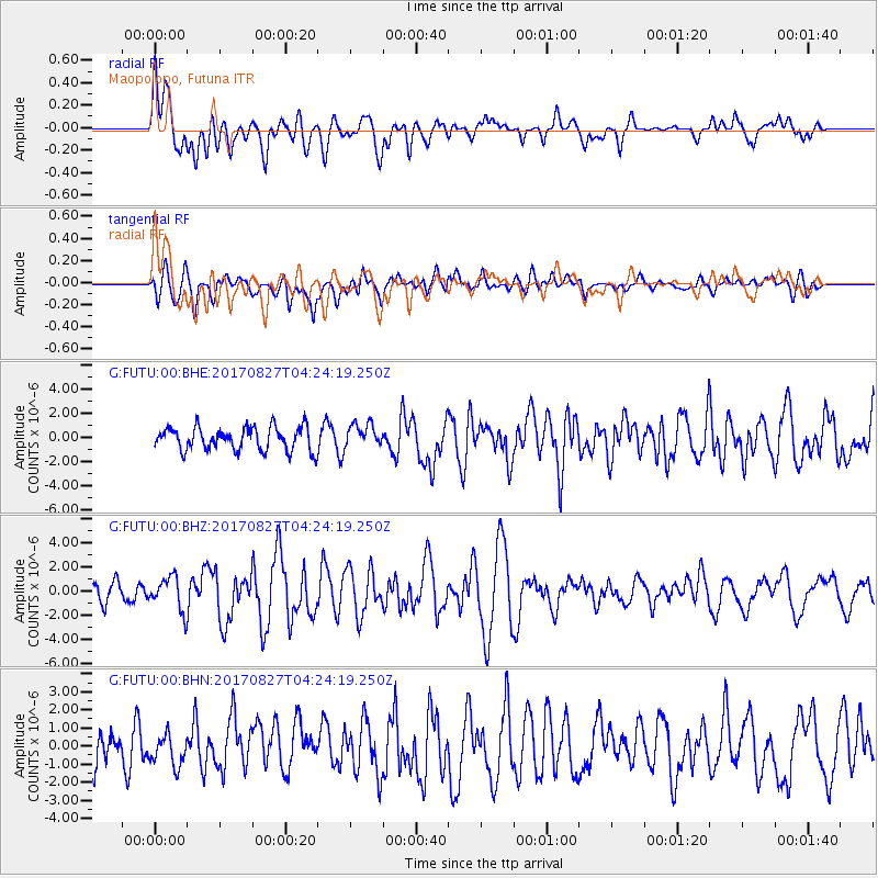
FUTU Maopo'opo, Futuna - Earthquake Result Viewer
*The percent match for this event was below the threshold and hence no stack was calculated.
| Earthquake location: |
Admiralty Islands Region, P.N.G. |
| Earthquake latitude/longitude: |
-1.4/148.1 |
| Earthquake time(UTC): |
2017/08/27 (239) 04:17:51 GMT |
| Earthquake Depth: |
10 km |
| Earthquake Magnitude: |
6.6 Mi |
| Earthquake Catalog/Contributor: |
NEIC PDE/at |
|
| Network: |
G GEOSCOPE |
| Station: |
FUTU Maopo'opo, Futuna |
| Lat/Lon: |
14.31 S/178.12 W |
| Elevation: |
97 m |
|
| Distance: |
35.8 deg |
| Az: |
112.745 deg |
| Baz: |
287.994 deg |
| Ray Param: |
$rayparam |
*The percent match for this event was below the threshold and hence was not used in the summary stack. |
|
| Radial Match: |
67.420265 % |
| Radial Bump: |
400 |
| Transverse Match: |
65.66743 % |
| Transverse Bump: |
400 |
| SOD ConfigId: |
2140511 |
| Insert Time: |
2017-09-09 20:12:02.772 +0000 |
| GWidth: |
2.5 |
| Max Bumps: |
400 |
| Tol: |
0.001 |
|
Signal To Noise
| Channel | StoN | STA | LTA |
| G:FUTU:00:BHZ:20170827T04:24:19.250Z | 2.254377 | 1.3993524E-6 | 6.207269E-7 |
| G:FUTU:00:BHN:20170827T04:24:19.250Z | 1.0487021 | 7.9696906E-7 | 7.599575E-7 |
| G:FUTU:00:BHE:20170827T04:24:19.250Z | 1.0134785 | 9.688174E-7 | 9.559328E-7 |
| Arrivals |
| Ps | |
| PpPs | |
| PsPs/PpSs | |


