You are here: Home > Network List > TA - USArray Transportable Network (new EarthScope stations) Stations List
> Station F26K Sheenjek River, AK, USA > Earthquake Result Viewer
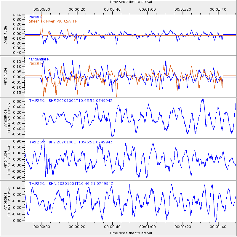
F26K Sheenjek River, AK, USA - Earthquake Result Viewer
*The percent match for this event was below the threshold and hence no stack was calculated.
| Earthquake location: |
New Britain Region, P.N.G. |
| Earthquake latitude/longitude: |
-6.1/148.7 |
| Earthquake time(UTC): |
2020/10/01 (275) 10:34:48 GMT |
| Earthquake Depth: |
109 km |
| Earthquake Magnitude: |
6.0 mww |
| Earthquake Catalog/Contributor: |
NEIC PDE/us |
|
| Network: |
TA USArray Transportable Network (new EarthScope stations) |
| Station: |
F26K Sheenjek River, AK, USA |
| Lat/Lon: |
67.69 N/144.15 W |
| Elevation: |
683 m |
|
| Distance: |
87.1 deg |
| Az: |
20.63 deg |
| Baz: |
246.614 deg |
| Ray Param: |
$rayparam |
*The percent match for this event was below the threshold and hence was not used in the summary stack. |
|
| Radial Match: |
50.53171 % |
| Radial Bump: |
400 |
| Transverse Match: |
49.349243 % |
| Transverse Bump: |
382 |
| SOD ConfigId: |
22732711 |
| Insert Time: |
2020-10-15 10:47:12.811 +0000 |
| GWidth: |
2.5 |
| Max Bumps: |
400 |
| Tol: |
0.001 |
|
Signal To Noise
| Channel | StoN | STA | LTA |
| TA:F26K: :BHZ:20201001T10:46:51.074994Z | 1.9743253 | 5.9402726E-7 | 3.0087608E-7 |
| TA:F26K: :BHN:20201001T10:46:51.074994Z | 0.6704047 | 1.4435123E-7 | 2.1531955E-7 |
| TA:F26K: :BHE:20201001T10:46:51.074994Z | 1.5855578 | 2.4888521E-7 | 1.5697013E-7 |
| Arrivals |
| Ps | |
| PpPs | |
| PsPs/PpSs | |


