You are here: Home > Network List > TA - USArray Transportable Network (new EarthScope stations) Stations List
> Station I30M Mount Dempster, Yukon, CAN > Earthquake Result Viewer
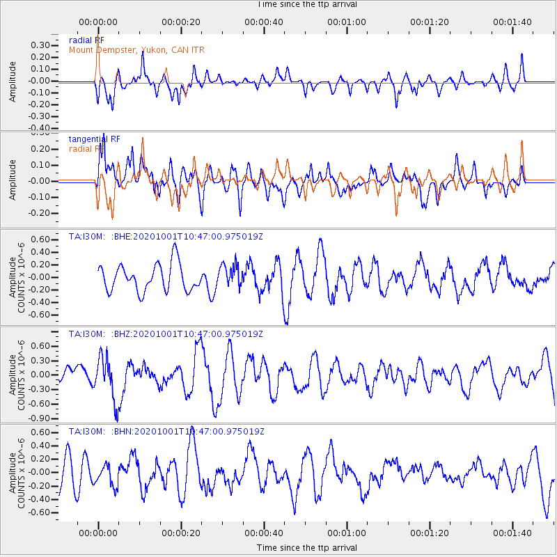
I30M Mount Dempster, Yukon, CAN - Earthquake Result Viewer
*The percent match for this event was below the threshold and hence no stack was calculated.
| Earthquake location: |
New Britain Region, P.N.G. |
| Earthquake latitude/longitude: |
-6.1/148.7 |
| Earthquake time(UTC): |
2020/10/01 (275) 10:34:48 GMT |
| Earthquake Depth: |
109 km |
| Earthquake Magnitude: |
6.0 mww |
| Earthquake Catalog/Contributor: |
NEIC PDE/us |
|
| Network: |
TA USArray Transportable Network (new EarthScope stations) |
| Station: |
I30M Mount Dempster, Yukon, CAN |
| Lat/Lon: |
65.22 N/136.38 W |
| Elevation: |
1399 m |
|
| Distance: |
89.2 deg |
| Az: |
24.018 deg |
| Baz: |
253.839 deg |
| Ray Param: |
$rayparam |
*The percent match for this event was below the threshold and hence was not used in the summary stack. |
|
| Radial Match: |
54.445953 % |
| Radial Bump: |
386 |
| Transverse Match: |
59.266796 % |
| Transverse Bump: |
400 |
| SOD ConfigId: |
22732711 |
| Insert Time: |
2020-10-15 10:47:33.054 +0000 |
| GWidth: |
2.5 |
| Max Bumps: |
400 |
| Tol: |
0.001 |
|
Signal To Noise
| Channel | StoN | STA | LTA |
| TA:I30M: :BHZ:20201001T10:47:00.975019Z | 2.3649316 | 4.5297526E-7 | 1.9153842E-7 |
| TA:I30M: :BHN:20201001T10:47:00.975019Z | 0.7263353 | 1.5532571E-7 | 2.138485E-7 |
| TA:I30M: :BHE:20201001T10:47:00.975019Z | 0.82368606 | 1.7509261E-7 | 2.12572E-7 |
| Arrivals |
| Ps | |
| PpPs | |
| PsPs/PpSs | |


