You are here: Home > Network List > TA - USArray Transportable Network (new EarthScope stations) Stations List
> Station E20K Nigu River, AK, USA > Earthquake Result Viewer
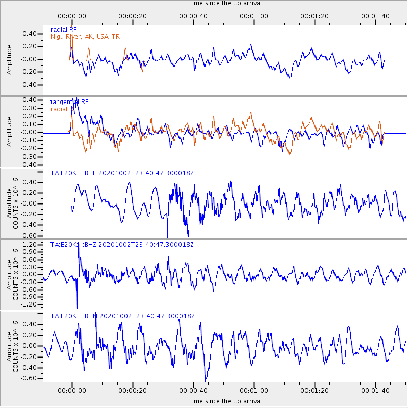
E20K Nigu River, AK, USA - Earthquake Result Viewer
*The percent match for this event was below the threshold and hence no stack was calculated.
| Earthquake location: |
Mariana Islands |
| Earthquake latitude/longitude: |
18.8/146.0 |
| Earthquake time(UTC): |
2020/10/02 (276) 23:31:13 GMT |
| Earthquake Depth: |
78 km |
| Earthquake Magnitude: |
5.2 Mww |
| Earthquake Catalog/Contributor: |
NEIC PDE/us |
|
| Network: |
TA USArray Transportable Network (new EarthScope stations) |
| Station: |
E20K Nigu River, AK, USA |
| Lat/Lon: |
68.26 N/156.19 W |
| Elevation: |
866 m |
|
| Distance: |
61.0 deg |
| Az: |
21.152 deg |
| Baz: |
246.53 deg |
| Ray Param: |
$rayparam |
*The percent match for this event was below the threshold and hence was not used in the summary stack. |
|
| Radial Match: |
46.552734 % |
| Radial Bump: |
400 |
| Transverse Match: |
55.862957 % |
| Transverse Bump: |
400 |
| SOD ConfigId: |
22732711 |
| Insert Time: |
2020-10-16 23:43:19.471 +0000 |
| GWidth: |
2.5 |
| Max Bumps: |
400 |
| Tol: |
0.001 |
|
Signal To Noise
| Channel | StoN | STA | LTA |
| TA:E20K: :BHZ:20201002T23:40:47.300018Z | 2.4342368 | 4.3276918E-7 | 1.7778434E-7 |
| TA:E20K: :BHN:20201002T23:40:47.300018Z | 1.2741787 | 2.4000454E-7 | 1.8836019E-7 |
| TA:E20K: :BHE:20201002T23:40:47.300018Z | 1.3251636 | 2.5320077E-7 | 1.9107134E-7 |
| Arrivals |
| Ps | |
| PpPs | |
| PsPs/PpSs | |


