You are here: Home > Network List > US - United States National Seismic Network Stations List
> Station DGMT Dagmar, Montana, USA > Earthquake Result Viewer
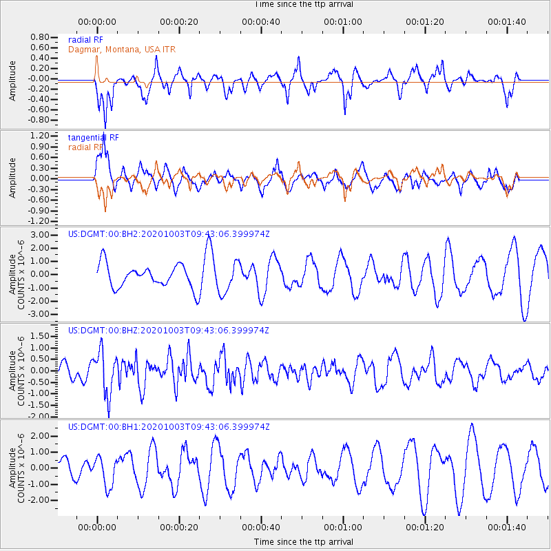
DGMT Dagmar, Montana, USA - Earthquake Result Viewer
*The percent match for this event was below the threshold and hence no stack was calculated.
| Earthquake location: |
Southeast Of Honshu, Japan |
| Earthquake latitude/longitude: |
33.5/140.9 |
| Earthquake time(UTC): |
2020/10/03 (277) 09:31:35 GMT |
| Earthquake Depth: |
59 km |
| Earthquake Magnitude: |
5.5 mww |
| Earthquake Catalog/Contributor: |
NEIC PDE/us |
|
| Network: |
US United States National Seismic Network |
| Station: |
DGMT Dagmar, Montana, USA |
| Lat/Lon: |
48.47 N/104.20 W |
| Elevation: |
0.0 m |
|
| Distance: |
79.9 deg |
| Az: |
37.821 deg |
| Baz: |
309.671 deg |
| Ray Param: |
$rayparam |
*The percent match for this event was below the threshold and hence was not used in the summary stack. |
|
| Radial Match: |
65.28667 % |
| Radial Bump: |
393 |
| Transverse Match: |
50.959846 % |
| Transverse Bump: |
398 |
| SOD ConfigId: |
22732711 |
| Insert Time: |
2020-10-17 09:53:54.746 +0000 |
| GWidth: |
2.5 |
| Max Bumps: |
400 |
| Tol: |
0.001 |
|
Signal To Noise
| Channel | StoN | STA | LTA |
| US:DGMT:00:BHZ:20201003T09:43:06.399974Z | 2.6536107 | 9.398968E-7 | 3.5419544E-7 |
| US:DGMT:00:BH1:20201003T09:43:06.399974Z | 1.3182402 | 9.327012E-7 | 7.075351E-7 |
| US:DGMT:00:BH2:20201003T09:43:06.399974Z | 1.3360759 | 1.1339162E-6 | 8.486914E-7 |
| Arrivals |
| Ps | |
| PpPs | |
| PsPs/PpSs | |


