You are here: Home > Network List > CN - Canadian National Seismograph Network Stations List
> Station INK INUVIK, NT > Earthquake Result Viewer
INK INUVIK, NT - Earthquake Result Viewer
*The percent match for this event was below the threshold and hence no stack was calculated.
| Earthquake location: |
Eastern Greenland |
| Earthquake latitude/longitude: |
69.3/-29.8 |
| Earthquake time(UTC): |
2020/10/03 (277) 13:22:47 GMT |
| Earthquake Depth: |
10 km |
| Earthquake Magnitude: |
5.3 Mww |
| Earthquake Catalog/Contributor: |
NEIC PDE/us |
|
| Network: |
CN Canadian National Seismograph Network |
| Station: |
INK INUVIK, NT |
| Lat/Lon: |
68.31 N/133.53 W |
| Elevation: |
44 m |
|
| Distance: |
33.3 deg |
| Az: |
318.81 deg |
| Baz: |
39.031 deg |
| Ray Param: |
$rayparam |
*The percent match for this event was below the threshold and hence was not used in the summary stack. |
|
| Radial Match: |
67.39409 % |
| Radial Bump: |
400 |
| Transverse Match: |
72.7345 % |
| Transverse Bump: |
400 |
| SOD ConfigId: |
22732711 |
| Insert Time: |
2020-10-17 13:30:49.085 +0000 |
| GWidth: |
2.5 |
| Max Bumps: |
400 |
| Tol: |
0.001 |
|
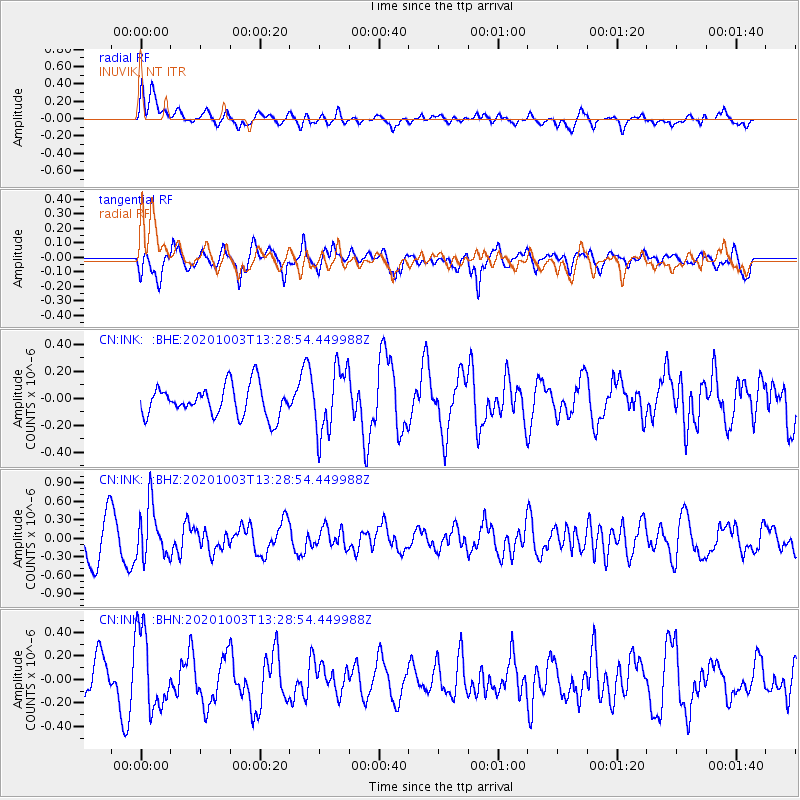
Signal To Noise
| Channel | StoN | STA | LTA |
| CN:INK: :BHZ:20201003T13:28:54.449988Z | 1.297122 | 4.2221436E-7 | 3.2550088E-7 |
| CN:INK: :BHN:20201003T13:28:54.449988Z | 1.9901416 | 3.3182934E-7 | 1.6673654E-7 |
| CN:INK: :BHE:20201003T13:28:54.449988Z | 2.1162674 | 2.4021733E-7 | 1.1350991E-7 |
| Arrivals |
| Ps | |
| PpPs | |
| PsPs/PpSs | |


