You are here: Home > Network List > TA - USArray Transportable Network (new EarthScope stations) Stations List
> Station G31M Satah River, YT, CAN > Earthquake Result Viewer
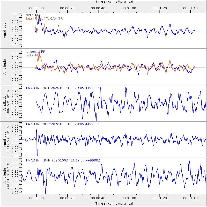
G31M Satah River, YT, CAN - Earthquake Result Viewer
*The percent match for this event was below the threshold and hence no stack was calculated.
| Earthquake location: |
Eastern Greenland |
| Earthquake latitude/longitude: |
69.3/-29.8 |
| Earthquake time(UTC): |
2020/10/03 (277) 13:22:47 GMT |
| Earthquake Depth: |
10 km |
| Earthquake Magnitude: |
5.3 Mww |
| Earthquake Catalog/Contributor: |
NEIC PDE/us |
|
| Network: |
TA USArray Transportable Network (new EarthScope stations) |
| Station: |
G31M Satah River, YT, CAN |
| Lat/Lon: |
66.92 N/134.27 W |
| Elevation: |
61 m |
|
| Distance: |
34.5 deg |
| Az: |
317.67 deg |
| Baz: |
37.396 deg |
| Ray Param: |
$rayparam |
*The percent match for this event was below the threshold and hence was not used in the summary stack. |
|
| Radial Match: |
69.469 % |
| Radial Bump: |
400 |
| Transverse Match: |
46.263268 % |
| Transverse Bump: |
400 |
| SOD ConfigId: |
22732711 |
| Insert Time: |
2020-10-17 13:44:25.590 +0000 |
| GWidth: |
2.5 |
| Max Bumps: |
400 |
| Tol: |
0.001 |
|
Signal To Noise
| Channel | StoN | STA | LTA |
| TA:G31M: :BHZ:20201003T13:29:05.449988Z | 3.7557933 | 6.96807E-7 | 1.8552856E-7 |
| TA:G31M: :BHN:20201003T13:29:05.449988Z | 1.2856938 | 3.1686616E-7 | 2.4645541E-7 |
| TA:G31M: :BHE:20201003T13:29:05.449988Z | 1.000689 | 3.4085403E-7 | 3.4061935E-7 |
| Arrivals |
| Ps | |
| PpPs | |
| PsPs/PpSs | |


